

If you live in Fair Oaks Ranch or the surrounding 78015 area, you have probably heard the name Post Oak by now. It is the development that has come up at city council meetings, in neighborhood conversations, and on community social media pages. Some residents are excited about it. Others are concerned. Most want to understand what is actually happening — without the noise.
This article is my attempt to lay out the facts. Not opinions about whether growth is good or bad, but a clear, sourced explanation of what the Post Oak development includes, how it is funded, how the approval process worked, and what it means for people who already live here. Whether you support the project, oppose it, or are still making up your mind, being informed is the starting point for any productive conversation.
Responsible growth is not an oxymoron. But whether growth is responsible depends entirely on the details — density, funding mechanisms, infrastructure standards, and regulatory oversight. This article covers those details.
Current Status Snapshot — June 2026
Key Takeaways
- Low density, dramatically reduced: ~278 homes on minimum-one-acre lots — roughly 60% fewer homes than the original 635-home proposal, with no centralized wastewater plant.
- PID protects existing taxpayers: ~$60M in infrastructure funded entirely by new development, not the existing city budget.
- Annexation brings city standards: Development now subject to Fair Oaks Ranch zoning, design review, and infrastructure requirements instead of ETJ-only rules.
- Phased approach: Phase 1 (~65 lots) approved and under construction, with three additional phases to follow.
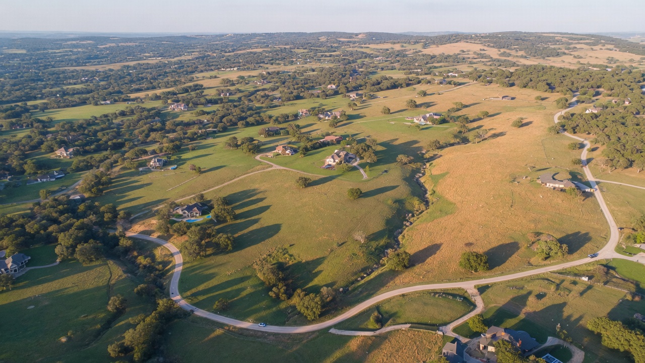
The Story Behind the Development: A Decade in the Making
Before I walk you through the details of what Post Oak includes today, I want to give you the full picture of how we got here — because the history matters. Understanding the backstory is the difference between evaluating the current plan on its merits and reacting to a name without context. This development did not appear out of nowhere. It is the product of more than a decade of negotiation, legal dispute, community pushback, and eventual compromise. That process — messy as it was — is exactly why the current plan looks the way it does.
It started as "The Reserve at Fair Oaks Ranch"
The project you now know as Post Oak was originally proposed under a different name: The Reserve at Fair Oaks Ranch. The developer's initial vision was substantially different from what is on the table today. In 2013, the development agreement proposed a high-density plan of approximately 635 to 645 homes — more than double the current proposal — along with a private wastewater treatment plant to service the community. For context, that would have meant roughly two homes per acre across the tract, a density level that would have fundamentally altered the character of the surrounding area.
2014: Fair Oaks Ranch says no
The city of Fair Oaks Ranch reviewed the proposal and rejected the annexation. That decision reflected a clear judgment: a 635-home subdivision with a private treatment facility was not consistent with the community's identity, infrastructure capacity, or long-term planning goals. It was a straightforward exercise of local governance — a city determining that a proposed development did not meet its standards.
What followed was a lawsuit
The rejection did not end the conversation. The dispute escalated into litigation between the developer and the city of Fair Oaks Ranch, centering on the developer's rights to develop the property and the city's authority to regulate or block that development within its extraterritorial jurisdiction. Legal disputes of this nature are not uncommon in Texas, where the tension between property rights and municipal control is a recurring theme — but they are expensive, time-consuming, and adversarial by nature.
Nobody wins a lawsuit like this quickly, and the uncertainty that litigation creates is its own form of damage to a community that deserves clarity about what is going to happen next door.
2018: A settlement that changed the trajectory
After years of legal wrangling, the parties reached a settlement in 2018. The terms were significant: rather than the high-density, municipally-serviced development originally proposed, the settlement allowed for limited development within the extraterritorial jurisdiction using wells and septic systems — no private treatment plant, no municipal water and sewer connections, and importantly, a substantially reduced scope. The adversarial ETJ-only path that followed the 2014 rejection was a compromise born of litigation, not collaboration. It was a starting point, not a final destination.
From adversarial to collaborative: the current proposal
The 278-lot plan on approximately 345 acres that exists today represents a dramatic evolution from where this project started. The original 635 to 645 home proposal has been reduced by nearly 60% in density. Where the developer initially wanted to build two homes per acre with a private wastewater facility, the approved plan includes minimum-one-acre lots (~1.24 acres average, ~0.81 homes per acre) with PID-funded infrastructure and cooperative annexation into the city of Fair Oaks Ranch.
That shift did not happen by accident. It happened because the community engaged, the city pushed back, and over the course of more than a decade, a negotiation process replaced the adversarial one. The cooperative annexation path under the approved plan — where the development comes under city ordinances, city building standards, and city oversight — is fundamentally different from the ETJ-only approach that followed the 2014 rejection. The developer chose to work within the city's regulatory framework rather than around it. That choice was not inevitable. It was earned through sustained community advocacy and a city government that held its ground.
2023: SB 2038 and the shift in political leverage
An important factor shaped the timing and trajectory of the 2023 resubmission. Senate Bill 2038, passed by the 88th Texas Legislature and effective September 1, 2023, fundamentally altered the regulatory landscape for development in a city's extraterritorial jurisdiction. Under the new law, landowners within a city's ETJ gained the ability to petition for release from the ETJ entirely — and if the city did not act on the petition within 90 days, the release became automatic.
This was not a minor procedural change. Before SB 2038, a city like Fair Oaks Ranch held meaningful regulatory authority over development activity in its ETJ, even without annexation. The city could impose development standards, require infrastructure improvements, and exert leverage in negotiations precisely because the developer operated under the city's jurisdictional umbrella.
SB 2038 changed that equation. A developer with land in the Fair Oaks Ranch ETJ now had a clear statutory path to bypass the city's authority altogether — to simply petition out of the ETJ, build under county permitting (which in most Texas counties is minimal), and proceed without city-mandated density limits, infrastructure standards, or tree preservation requirements.
In the context of Post Oak, this legislative change gave the developer significant structural leverage. The city faced a binary choice: cooperate on a structured development plan it could influence through annexation, zoning, and negotiated terms — or risk losing control of development on its doorstep entirely. Under the cooperative annexation path, the city could require one-acre minimums, PID-funded infrastructure, city water connections, tree preservation standards, and ongoing HOA oversight. Under the SB 2038 ETJ-release path, none of those requirements would apply.
This dynamic does not diminish the role that community advocacy and city leadership played in shaping the outcome — those factors were real and essential throughout the decade-long process. But it provides important context for why the city chose the cooperative path rather than continuing to resist.
The political landscape had shifted. The developer resubmitted in 2023 not in a vacuum, but under a new set of legal conditions that made the ETJ-only alternative a realistic and potentially irreversible option. The cooperative annexation agreement that followed — with its negotiated community benefits, city oversight, and structured infrastructure plan — was the product of a city exercising whatever influence it still had within a rapidly narrowing window.
Why this history matters
I lay this out because it is the foundation for evaluating the current plan honestly. The "responsible growth" framing that surrounds Post Oak is not a marketing slogan — it is a description of how the project evolved. The difference between 635 homes on a private treatment plant and 278 lots with minimum-one-acre homesites, PID-funded infrastructure, and city oversight is not incremental. It is transformative. And it happened because residents, city staff, and elected officials engaged with the process over many years and refused to accept the first offer on the table.
That is how good outcomes happen in community development. Not through blanket opposition that results in unplanned ETJ growth, and not through uncritical acceptance of whatever a developer proposes. Through engagement, negotiation, and the patience to see a process through to a better result than where it started.
Project Timeline: From Proposal to Current Status
The Post Oak development has been in motion for over a decade. The table below maps the full arc — from the original high-density proposal through lawsuit, settlement, resubmission, legislative changes, city approval, and into active construction. Use it as a quick reference for where the project has been and where it stands today.
| Date | Milestone | Status |
|---|---|---|
| 2013 | Original high-density proposal submitted as "The Reserve at Fair Oaks Ranch" — approximately 635–645 homes with a private wastewater treatment plant | Superseded |
| 2014 | Fair Oaks Ranch city council rejects annexation of the high-density proposal | Resolved |
| 2014–2018 | Lawsuit and legal proceedings between developer and the city over ETJ development rights | Resolved |
| 2018 | Settlement reached — allows limited ETJ development with wells and septic; reduced scope from original plan | Resolved |
| 2023 | Developer resubmits proposal under cooperative annexation path. SB 2038 (ETJ reform) takes effect September 1, 2023 — fundamentally altering the regulatory landscape for ETJ development | Resolved |
| 2024–2025 | City review process — public hearings, city council review of development agreement and PID petition | Resolved |
| May 20, 2025 | City council approves development agreement and PID petition | Approved |
| 2025 | Annexation into Fair Oaks Ranch and zoning actions completed | Approved |
| 2026 | Phase 1 preliminary and final plat approvals (~65 lots) | Approved |
| 2026 (mid) | Construction imminent or underway on Phase 1 | Active |
Build-Out Phases
The development is planned in four phases. This phased approach allows infrastructure — roads, water connections, drainage — to scale incrementally rather than all at once, reducing the immediate impact on surrounding streets and utilities.
| Phase | Lots | Status |
|---|---|---|
| Phase 1 | ~65 lots | Plat approved; construction underway |
| Phase 2 | Remaining lots | In planning |
| Phase 3 | Remaining lots | In planning |
| Phase 4 | Remaining lots | In planning |
Current Status — June 2026
Post Oak at a Glance
| Location | North of Ammann Road, bordered by Ammann Road to the south and west, near Rolling Acres Trail, directly across from Stone Creek Ranch subdivision — Kendall/Bexar County, TX 78015 |
| Tract size | ~345 acres |
| Lot size | Minimum one acre per homesite (~1.24 acres average) |
| Home count | ~278 lots (see history for how this evolved from the original proposal) |
| Density | ~0.81 homes per acre — lower than most new construction in the area |
| Funding mechanism | Public Improvement District (PID) — infrastructure funded by the development, not existing taxpayers |
| Developer | BitterBlue — local Hill Country builder known for high-end custom homes |
| Infrastructure | City water (Fair Oaks Ranch municipal service) with individual on-site septic systems per lot |
| Governance | Subject to Fair Oaks Ranch city ordinances and development standards following annexation; city retains HOA maintenance oversight |
| School district | Boerne ISD — assigned campuses: Van Raub Elementary (K–5), Voss Middle School (6–8), Boerne Champion High School (9–12). Verify by specific address. |
| Status | Approved and platted. Development agreement and PID petition approved May 20, 2025. Annexation and zoning complete. Phase 1 preliminary and final plat approved (~65 lots). Construction imminent or underway (mid-2026). See full project timeline below. |
Development Location

What Is the Post Oak Development?
That is how we got here — a decade of negotiation, legal dispute, and community advocacy. Now let's look at what the development actually includes today, from lot sizes and infrastructure to who is building it and why the details matter.
This is not a repeat of 2013. The approved plan represents a nearly 60% reduction in density, eliminates the centralized wastewater plant the city rejected, and brings the development under full city oversight through cooperative annexation.
The Post Oak development is an approved residential community on a tract located north of Ammann Road, directly across from Stone Creek Ranch. The development agreement and PID petition were approved by the city of Fair Oaks Ranch on May 20, 2025, following public hearings and community input [14]. Phase 1 preliminary and final plat approvals (~65 lots) have been obtained, annexation and zoning are complete, and construction is underway. Full project details are in the history and timeline sections above.
What distinguishes Post Oak from a typical new-build subdivision is the density. The development aligns with the low-density character that defines Fair Oaks Ranch — this is not a project with 60-foot lots stacked along cul-de-sacs. It is a deliberate addition of housing that respects the existing community's expectations.
Like any development, the plan evolved through the review process. Initial concepts were refined based on community feedback and city planning input. What was approved reflects modifications that responded to resident concerns — that is how the process is supposed to work, and it is worth recognizing when it does.
The development includes infrastructure through a Public Improvement District (PID), meaning the roads, drainage, and water service lines (the city water connection to each lot) are funded by property owners within the development — not by existing Fair Oaks Ranch taxpayers. Notably, wastewater is not part of the PID scope. Each home uses an individual on-site septic system — specifically Aerobic Treatment Units (ATUs) — rather than connecting to a centralized sewer network. More on how that works below.
Who is building it: BitterBlue
The developer behind Post Oak is BitterBlue, a local Hill Country builder with a reputation for high-end custom homes rather than high-volume tract development. That distinction matters when evaluating a project of this scale. BitterBlue is not a national production builder rolling through with cookie-cutter floor plans and a three-year exit strategy. They are a Hill Country-focused custom builder whose work is rooted in the area — and that local identity changes the incentive structure.
Custom builders stake their reputation on the quality and character of each community they create, because their next project depends on the reputation of the last one. High-volume tract developers, by contrast, optimize for speed, cost per unit, and margin. The builder's profile does not guarantee outcomes — contracts, ordinances, and enforcement do that — but it does shape the likely approach. A local custom builder annexing into a small city where they live and work has every reason to get the details right the first time.
That context is worth holding onto as you evaluate the rest of this article. The choices this development has made — minimum-one-acre lots, cooperative annexation, negotiated community benefits — are more consistent with a builder investing in a community's long-term view than with a volume developer optimizing for a quick build-out and move on.
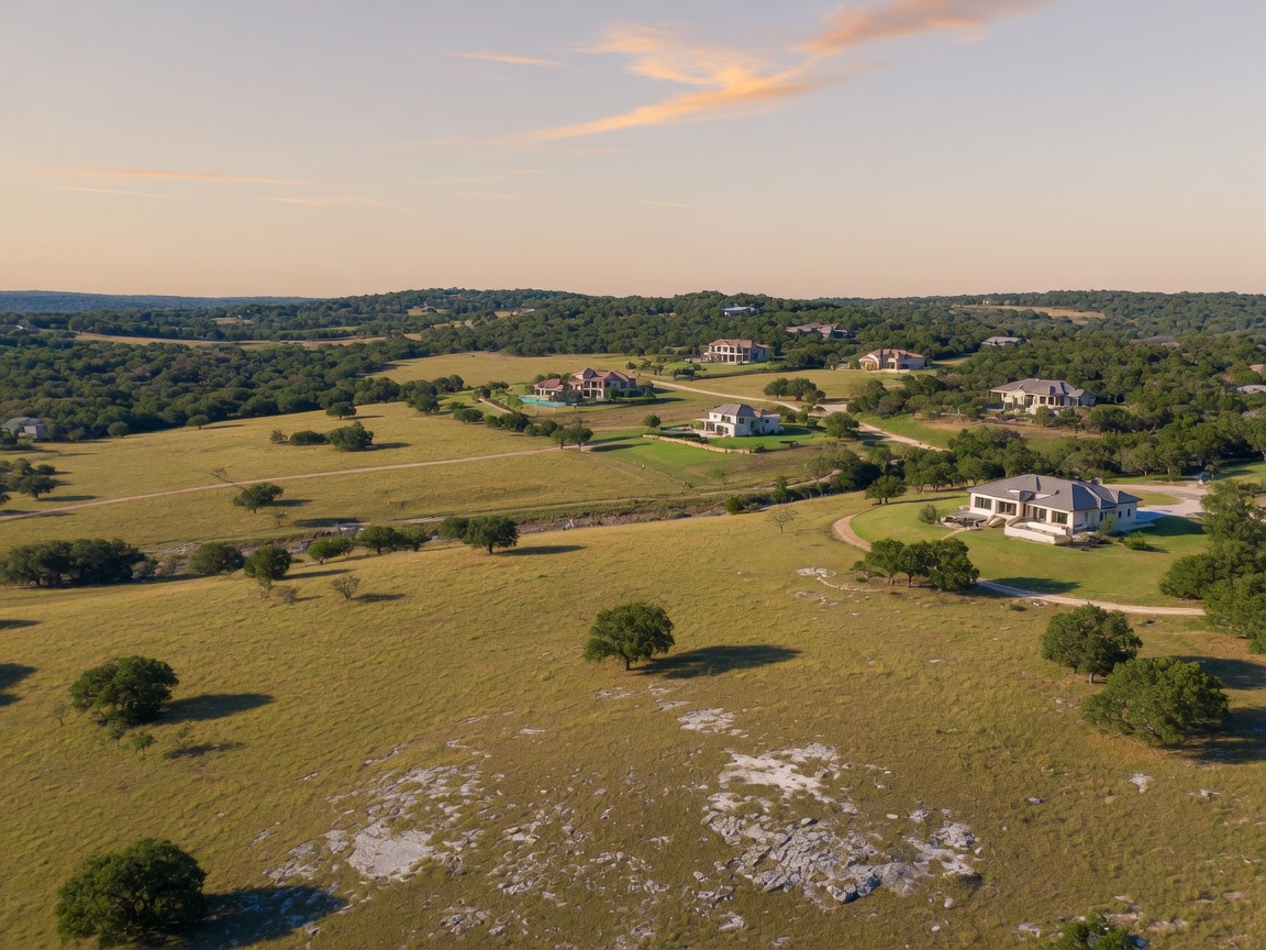
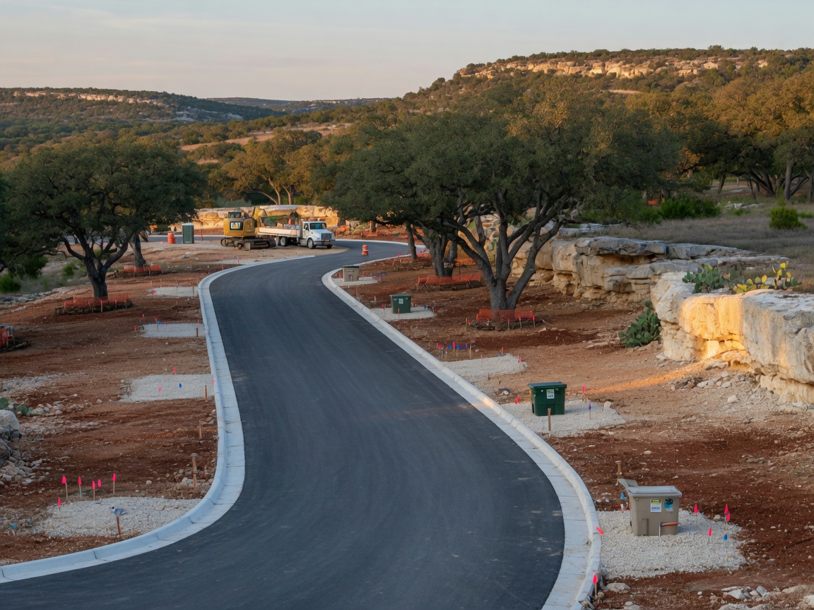
The Hill Country terrain surrounding Fair Oaks Ranch. The question facing the community is not whether development will happen, but what form it takes.
Why One-Acre Lots Matter
Density is the single most important variable in any development discussion. It determines how much traffic a project generates, how much water it consumes, how many students it sends to local schools, and how fundamentally it changes the character of a neighborhood. Here is how Post Oak's minimum-one-acre density compares to what exists around it and to typical new construction in the area.
Density Comparison
How Post Oak compares across the development spectrum
Traditional suburban tract
0.15–0.25 ac per home
Original proposal (2013)
~0.5 ac per home
Post Oak (approved)
~1.24 ac per home
Hill Country acreage dev
1–2 ac per home
Rural / agricultural
5+ ac per home
345
Total acres
278
Total homesites
1.24
Acres per home
~60%
Reduction from 2013
At approximately 0.81 homes per acre (~1.24 acres per lot), Post Oak sits between typical suburban development (which generates four to six times the density) and the established Fair Oaks Ranch estates that sit on two to five or more acres. It is lower density than nearly every new-build subdivision in the greater Boerne and San Antonio corridor.
That density difference translates into real, measurable impacts:
- Water demand: Fewer homes per acre means less total water consumption per acre of developed land — important in a region that draws from the Edwards Trinity and other aquifer systems.
- Traffic: Each home generates roughly 9 to 12 vehicle trips per day (ITE Trip Generation Manual data), regardless of lot size. But at the approved density, these lots produce a fraction of the road traffic that four to six homes per acre would. The road network absorbs this load far more gracefully.
- School capacity: Lower density means fewer students per acre. Boerne ISD, which serves most Fair Oaks Ranch addresses, is a high-performing district managing growth carefully. Lower-density development makes that management easier.
- Character preservation: Fair Oaks Ranch was built on the premise of space, privacy, and a rural setting. One-acre lots preserve that premise. The visual and experiential difference between an acre-lot home and a quarter-acre-lot home is significant — wider setbacks, more mature vegetation between structures, and a fundamentally different sense of density.
- Property values: Lower-density developments in established Hill Country communities have historically maintained stronger per-square-foot values than higher-density alternatives. Buyers pay a premium for space.
What this means
Post Oak's approved density is not "rural" by Fair Oaks Ranch standards — existing estates on two to five-plus acres are more spacious. But it is significantly lower than typical new construction in the area, and it was designed that way deliberately. For a new development entering an established community, this is a meaningful concession to existing character.
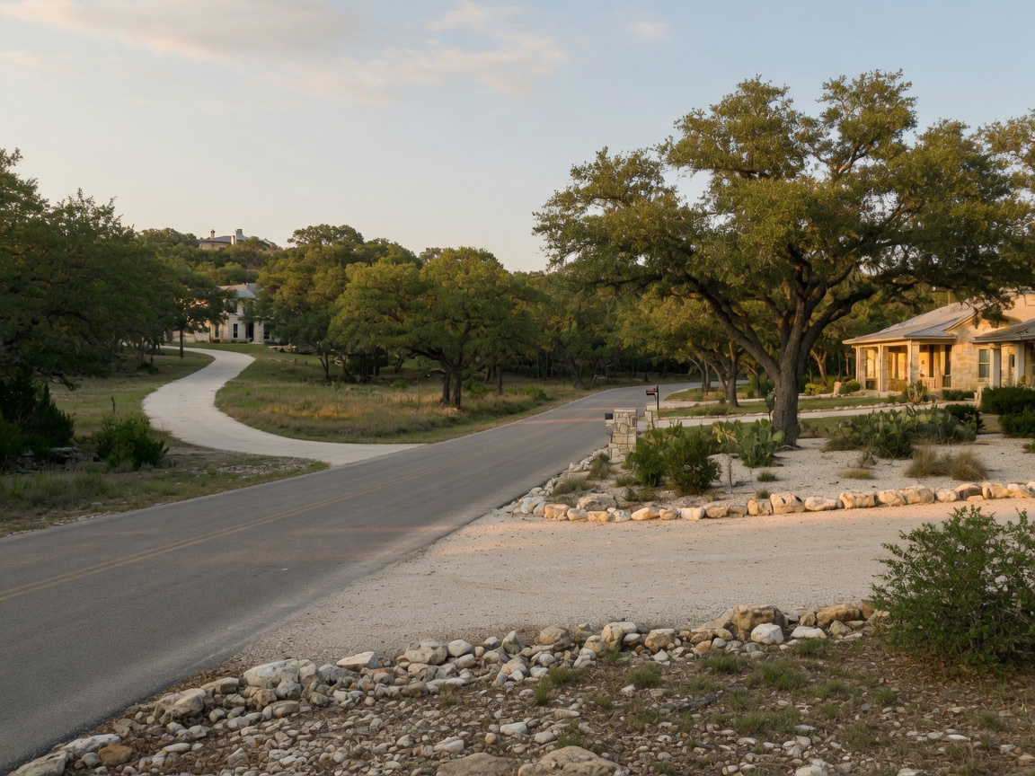
Low-density Hill Country neighborhoods with one-acre lots maintain the spaced, tree-lined character that defines the area.
How PID Funding Works (And Why It Matters to You)
This is the section that matters most to existing Fair Oaks Ranch homeowners — and it is the one that tends to generate the most confusion. So let me explain it in plain language.
What is a PID?
A Public Improvement District is a defined geographic area created by a city or county where property owners pay a special assessment to fund infrastructure. In the case of Post Oak, that infrastructure covers three specific categories: roads, drainage systems, and water service lines (the pipe connections from the city water main to each individual lot) [2]. According to city approvals, the total infrastructure cost covered by this PID is approximately $60 million — a figure that reflects the scale of roads, drainage, and water infrastructure required for the development. Critically, this entire amount is funded through assessments on the properties within the development, not through city bonds or existing taxpayer dollars.
What the PID does not fund is equally important: wastewater infrastructure is entirely excluded. There is no centralized sewer network, no shared wastewater collection system, and no municipal treatment facility in this development. Instead, each homesite operates its own individual on-site septic system — an Aerobic Treatment Unit (ATU) regulated by Kendall County and the Texas Commission on Environmental Quality (TCEQ) [12]. This is a deliberate design choice, not an oversight, and it represents a significant departure from the 2013 proposal. The original "Reserve at Fair Oaks Ranch" plan included a centralized private wastewater treatment plant to service 635 homes — the same type of facility that was one of the primary reasons the city rejected that proposal. The current plan eliminates that centralized plant entirely.
The shift to individual septic means the city has no centralized wastewater facility to oversee, operate, or maintain. It also means the municipal water system does not bear the additional demand that a centralized treatment plant would impose, since septic systems process wastewater on-site without drawing from the municipal water supply for treatment. For existing residents, this is a material structural benefit: simpler infrastructure, lower municipal cost, and no industrial wastewater facility in the neighborhood.
A PID is not an independent taxing authority like a Municipal Utility District (MUD). It does not levy property taxes in the traditional sense. Instead, it imposes a special assessment — a charge that is tied to the benefit the property receives from the improvements. Texas law authorizes cities and counties to create PIDs under Chapter 372 of the Texas Local Government Code, and the assessments are typically structured as annual installments plus interest [2].
How it works in this case
Here is the flow, step by step:
PID Funding Flow
How infrastructure gets paid for — without costing existing taxpayers
Step 1
Developer establishes PID
Submits Service & Assessment Plan to city
Step 2
City reviews & approves
Public hearings, council vote (May 2025)
Step 3
Assessments on tax bills
Annual charges to lots within the PID
Step 4
Funds collected
Revenue accumulates in PID fund
Step 5
Infrastructure built
Roads, drainage, water service lines
Developer may front costs: The developer often pays for infrastructure construction upfront and is reimbursed through PID assessments over time. This is standard practice — it means infrastructure gets built before buyers move in, and the cost is repaid by the properties that benefit from it.
Why this matters to existing residents
The critical point here is simple: PID-funded infrastructure means the development's roads, drainage, and water service lines are paid for by the new development, not by existing taxpayers. If Post Oak were not built, the city would not need to fund this infrastructure at all. If a higher-density development were proposed instead, the city might need to fund road widening, additional water capacity, or other infrastructure improvements through general obligation bonds — which would affect existing taxpayers.
The PID model shifts that cost burden onto the people who are actually creating the need. That is a feature, not a bug.
PID assessments do not increase existing residents' taxes. The entire ~$60M infrastructure cost is paid by property owners within the development — not by the city, not by the general fund, and not by anyone who already lives in Fair Oaks Ranch.
The tradeoff is real but borne by future buyers: anyone purchasing a home in the Post Oak development should understand that their annual carrying costs include PID assessments on top of property taxes. In comparable Hill Country lower-density developments, PID assessments typically run $1,800 to $3,600 per lot annually — roughly 0.5% to 1.0% of assessed value per year — and these are ongoing obligations, not one-time fees, continuing until the infrastructure bonds are retired. That is a cost they need to factor into their purchase decision. It is not a cost imposed on their neighbors.
The Annexation Process Explained
Annexation is the legal process by which a Texas city brings adjacent territory into its boundaries. For the Post Oak development, annexation means the project is governed by Fair Oaks Ranch city ordinances, development standards, and regulations — and contributes to the city's tax base [3]. Annexation and associated zoning actions for Post Oak have been completed as part of the cooperative development agreement.
How Texas annexation works
Texas cities have historically had broad annexation authority, allowing them to incorporate property within their extraterritorial jurisdiction (ETJ) — the area beyond city limits where the city has limited regulatory authority. However, House Bill 347 (passed May 2019) significantly reformed the process for Type A and Type B general law cities (which includes Fair Oaks Ranch) [5]. HB 347 built upon Senate Bill 6 from the 2017 special session [4], which first established the framework for limiting involuntary annexation. Under current law, involuntary annexation — annexing property without the owner's consent — has been substantially limited [3].
For a development like Post Oak, annexation typically proceeds through one of these paths:
- Voluntary annexation: The property owner or developer requests annexation, which is the most common path for planned developments that need city services and infrastructure.
- Annexation agreement: The developer and city negotiate an agreement specifying the terms of annexation — service levels, timeline, and development standards.
- Annexation by election: In some cases, an election may be held among affected property owners and registered voters in the area to be annexed.
Once annexed, the development becomes subject to the city's zoning, building codes, subdivision regulations, and maintenance standards. The city also provides municipal services — police, fire, code enforcement, and infrastructure maintenance.
Senate Bill 2038 and the ETJ escape valve
There is a critical piece of legislation that provides essential context for the Post Oak outcome: Senate Bill 2038, passed by the 88th Texas Legislature and effective September 1, 2023 [6]. This law fundamentally changed the dynamics between cities and property owners in their extraterritorial jurisdiction.
Under SB 2038, landowners within a city's ETJ can now petition the city to release their property from the ETJ entirely. If the city does not act on the petition within 90 days, the release is automatic. This means a developer with land in the Fair Oaks Ranch ETJ could — and in many cases would — simply exit the ETJ rather than negotiate with the city on development standards, infrastructure requirements, or annexation terms.
Why does this matter for Post Oak? Because if the developer had chosen to pursue the SB 2038 route instead of working cooperatively with Fair Oaks Ranch, the development could have been built with minimal city oversight. Without ETJ authority, the city would have had limited ability to enforce its development standards, require PID-funded infrastructure, or ensure compliance with community expectations. The result could have been higher-density development, no PID infrastructure funding mechanism, no city building code enforcement, and substantially less community input.
SB 2038 effectively removed the leverage cities once held over ETJ development. In that context, a voluntary annexation agreement with PID-funded infrastructure and one-acre lot minimums is not just a reasonable outcome — it is a significantly better outcome than the realistic alternative. The developer had the legal option to build with far fewer constraints. Choosing cooperation over confrontation produced a development that serves both the builder's interests and the community's expectations.
The cooperative plan puts the city in control, not the developer. Annexation means Fair Oaks Ranch sets the rules — zoning, building codes, tree preservation, road standards, HOA oversight — and enforces them. Under the ETJ-only alternative, none of those requirements would apply.
Why annexation benefits existing residents
This is an important point that often gets lost in the conversation: annexation gives the city regulatory control over how the development is built and maintained. Without annexation, the development could potentially be built in the ETJ with limited city oversight — meaning fewer protections for existing residents regarding construction standards, infrastructure quality, and long-term maintenance.
With annexation, the development must comply with the same rules that apply to every other property in Fair Oaks Ranch. That is a protection, not a threat.
Annexation also means new property owners begin paying city property taxes, which contributes to the city's revenue base. That additional revenue helps fund services for the entire community — not just the new development.
What the Cooperative Approach Actually Produced: Negotiated Community Benefits
The history and annexation process I have described above can feel abstract — legal mechanisms, legislative references, procedural paths. But the cooperative approach between the developer and the city of Fair Oaks Ranch produced concrete, tangible benefits that would not exist under the adversarial ETJ-only path. These are not aspirations or good-faith promises. They are specific conditions negotiated as part of the development agreement. This is where the \"responsible growth\" framing either holds up or does not.
I want to walk through the four most significant negotiated benefits — because they represent exactly the kind of outcomes that only happen when a developer chooses to work within the city's framework rather than around it.
Tree preservation requirements that exceed standard ordinances
One of the conditions of the development agreement is a set of tree preservation requirements that are stronger than baseline Fair Oaks Ranch city ordinances. This is not a cosmetic gesture. Hill Country live oaks and native hardwoods are a defining feature of the landscape — they are what make the area feel like the Hill Country and not like a generic suburban subdivision. Standard city tree ordinances set a minimum floor. The Post Oak development agreement raised that floor.
What this means in practice is that the developer is held to a higher standard for retaining existing trees during construction than a typical development would face. Fewer mature trees cleared. More canopy preserved between homesites. A finished product that looks like it was placed into the landscape rather than scraped clean and built from scratch.
Here is the critical comparison: under the ETJ-only path — where the development would have been built outside city limits with no annexation — there would be no city tree preservation ordinance at all. The developer could have cleared the site to whatever standard the county required, which in most Texas counties is minimal. The cooperative annexation agreement is the mechanism that created the leverage to require stronger protections. That is not a coincidence. That is negotiation producing a better outcome.
Ammann Road infrastructure improvements
The development agreement includes developer contributions to Ammann Road infrastructure improvements. Ammann Road is the primary local access corridor for the development and for the existing homes and ranches that front it. Any new development generating traffic on Ammann Road creates a wear-and-tear burden on a road that was not built for subdivision-level traffic volumes.
Under the cooperative annexation agreement, the developer is contributing to the cost of improvements to that road — not asking existing residents or the city's general fund to absorb the infrastructure cost of serving a new development. This is the same principle that governs PID-funded infrastructure within the development, extended to the arterial road that connects the development to the broader community.
Under the ETJ-only alternative, the developer would have had limited obligation to contribute to road improvements on adjacent public infrastructure. The city would have had no mechanism to require it. The cooperative path gave the city the leverage to make sure the development pays its own way on the roads its residents will use.
On-site septic with city water — a deliberate infrastructure choice
This is the infrastructure detail that requires the most careful explanation, because it involves a combination that sounds contradictory at first but is actually quite deliberate: the development uses individual on-site septic systems for wastewater while connecting to Fair Oaks Ranch municipal water service.
To understand why this matters, you have to remember what was rejected in 2013. The original \"Reserve at Fair Oaks Ranch\" proposal included a centralized private wastewater treatment plant — a large-scale facility that would have treated sewage for the entire 635-home development. That facility was one of the primary reasons the city rejected the proposal. A private treatment plant of that scale creates long-term operational risk, ongoing maintenance obligations, environmental liability, and a single point of failure for the community's wastewater management. It was, in many ways, the most problematic element of the original plan.
The approved plan eliminates the centralized treatment plant entirely. Instead, each homesite has its own individual septic system — aerobic or conventional, as permitted by Kendall County and the Texas Commission on Environmental Quality (TCEQ). Individual septic systems are regulated at the county and state level, not by the city, and they carry a fundamentally different risk profile than a centralized facility. A septic system serving one home affects one property. A malfunctioning centralized treatment plant affects an entire community. The decentralized approach distributes risk rather than concentrating it.
At the same time, the development connects to Fair Oaks Ranch municipal water service. This is not a given for developments on the edge of the Hill Country — many rely on private wells. Connecting to city water means the residents receive treated, tested, city-regulated water delivered through the municipal system. The city has oversight of water quality, pressure, and service standards. That is a level of consumer protection that private wells cannot guarantee.
The combination — city water with individual septic — is a pragmatic engineering choice for this location. It avoids the centralized wastewater plant that the community rightfully rejected in 2013, gives the city regulatory oversight on the water side where municipal infrastructure is well-suited to the task, and keeps the wastewater side decentralized where individual systems are simpler, lower-risk, and regulated by the county and state. It is a solution designed to address the specific concerns this community raised, not a developer's first-choice cost optimization.
HOA maintenance with city oversight
The development includes a Homeowner Association responsible for maintaining common areas, landscaping, and shared infrastructure within the community. That is standard for a development of this size. What is not standard — and what is a direct product of the cooperative negotiation — is the city's retention of oversight authority over HOA maintenance standards.
Here is why that matters. One of the most common failure modes in new developments is the gradual degradation of community common areas as HOA budgets tighten, boards change, and maintenance priorities shift. Five years after move-in, the landscaping is overgrown. Ten years after, the roads inside the development are cracking. Fifteen years after, the community amenity areas look neglected. This happens across Texas — it is one of the most predictable risks in any new subdivision.
The negotiated development agreement includes a provision that gives the city of Fair Oaks Ranch the authority to step in if HOA maintenance standards slip below acceptable levels. That means the city can require the HOA to address deferred maintenance, enforce landscaping and infrastructure standards, and ultimately ensure that the development does not become a long-term liability for the surrounding community. The city is not funding the HOA — the homeowners within the development pay for that. But the city retains the regulatory authority to ensure the work gets done.
Under the ETJ-only path, no such oversight mechanism would exist. The development could have been built, the HOA could have been formed, and the city would have had no standing to intervene if maintenance deteriorated. The cooperative annexation agreement created a backstop that protects not just the current residents, but the future ones too — and the existing community that lives adjacent to the development.
Why these details matter
These four negotiated benefits — stronger tree preservation, Ammann Road contributions, city water with individual septic, and HOA oversight — are not incidental features of the development. They are the concrete evidence that the cooperative annexation approach produced a better outcome than the adversarial ETJ path would have.
What the city gained: three strategic outcomes from the cooperative plan
Beyond the four negotiated benefits above, the cooperative framework delivered three broader strategic advantages to Fair Oaks Ranch as a municipality — outcomes that city statements and approvals reflect as part of the rationale for endorsing the revised plan rather than continuing to resist it:
- Significant new taxable value for the city's tax base. At an estimated $500,000 to $800,000 or more per homesite, the completed 278-lot development represents approximately $140 million to $220 million or more in new taxable property value entering the city's tax rolls. For a small city like Fair Oaks Ranch, that is a material expansion of the tax base — additional revenue collected at existing tax rates, distributed across a larger number of properties, and available to fund the shared services (fire, police, administration, roads) that all residents rely on. The infrastructure costs of the development are borne by the development itself through the PID, meaning the city gains a broader tax base without having subsidized the build-out. Under the ETJ-only alternative, any new taxable value would flow to the county and state, not to the city — because the land would not have been within city limits.
- Substantially lower municipal water demand than the 2013 proposal. The original 2013 plan included a centralized private wastewater treatment plant servicing 635 homes — a facility that would have required significant municipal water input for treatment operations and introduced ongoing operational and environmental risk to the city's doorstep. The cooperative plan replaces that entirely with individual on-site septic systems (aerobic treatment units) that process wastewater on-site without drawing on the municipal water supply for centralized treatment. The net effect: the approved development uses substantially less municipal water infrastructure and capacity than the 2013 proposal would have. For a Hill Country community where water supply is a perennial concern, this is not a minor distinction. It is one of the most consequential infrastructure differences between the plan the city rejected and the plan it approved.
- City zoning, design standards, and regulatory oversight — rather than unregulated ETJ development. By working within the cooperative annexation framework, the city brought the Post Oak land under its own zoning ordinances, building codes, infrastructure standards, and design review — the full regulatory apparatus that Fair Oaks Ranch applies to development within its boundaries. Without cooperative annexation, and particularly after SB 2038, the developer could have petitioned out of the ETJ entirely and built under county permitting, which in most Texas counties imposes minimal density, design, or infrastructure requirements. The city would have had no authority over lot sizes, no ability to require PID-funded infrastructure, no enforcement of tree preservation or road improvement standards, and no standing to oversee long-term HOA maintenance. The cooperative framework did not give the city everything it wanted. But it gave the city something the ETJ-only alternative never could: control.
When viewed through this lens, the city's approval of the cooperative plan was not a concession to developer pressure — it was a strategic decision that produced a measurably better outcome for Fair Oaks Ranch than the alternatives available. The city gained taxable value it would not otherwise have collected, secured an infrastructure model that uses substantially less municipal water than the predecessor plan, and brought the land under its own regulatory authority rather than ceding that authority to county-level permissiveness. That is the definition of a negotiated outcome that serves the city's interests.
Under the ETJ-only alternative — the path available under SB 2038 — the developer could have built outside city limits with no city tree ordinances, no city-mandated road contributions, no connection to municipal water, and no city oversight of long-term maintenance standards. The community would have had no leverage, no regulatory framework, and no enforcement mechanism. The development would have happened regardless — Texas property rights make that clear — but it would have happened without any of the constraints that make it workable for the people who already live here.
The cooperative path did not produce a perfect outcome. No negotiation produces perfection. But it produced measurably, specifically, concretely better outcomes across every major category that residents identified as important. That is what responsible growth looks like when it is more than a slogan.
Water Supply and Infrastructure Details
The infrastructure decisions behind Post Oak are not just policy abstractions — they determine the day-to-day experience of living in the development and the long-term reliability of the services that support it. The previous section described why the city water plus individual septic combination was a negotiated choice. Here, I want to unpack what that means in practical terms: where the water comes from, how the septic systems work, and what the developer is contributing to shared infrastructure beyond the property boundary.
City water service: where it comes from and what it means
Post Oak will connect to Fair Oaks Ranch municipal water service rather than relying on individual private wells. This is a meaningful distinction for anyone evaluating the development's long-term reliability. The city's water supply draws from groundwater wells, most likely tapping the Edwards Trinity or Carrizo-Wilcox aquifer systems that underlie this part of the Hill Country. Those aquifers are the same water sources that serve communities across the region, and they are regulated by the Edwards Aquifer Authority and relevant groundwater conservation districts.
Connecting all homes to the municipal system means the city must ensure sufficient capacity to serve the development at full build-out — not just at initial connection, but during peak summer demand when landscape irrigation is at its highest and household water use tends to spike. The city's water infrastructure was built to serve the existing community, and adding hundreds of service connections represents a meaningful increase in total demand. Whether the city has conducted a formal capacity assessment to confirm its system can reliably serve this additional load is a reasonable question for residents to raise. If the assessment has been done and the results are favorable, that information should be publicly available. If it has not been done, the concern is legitimate.
The advantage of municipal water service over individual private wells is substantial. City water provides treated, tested water delivered at reliable pressure through a maintained distribution system. The city has regulatory oversight of water quality, conducts regular testing, and is responsible for maintaining the infrastructure that delivers it. Private wells, by contrast, fluctuate with drought conditions, require homeowner maintenance and periodic testing, and can experience pressure or quality variations that a municipal system is designed to prevent. For a development of this size, municipal service provides a level of reliability and consumer protection that private wells cannot match at scale.
Water Availability Certification: the legal proof behind plat approval
If you are relocating from California, water scarcity is likely the first concern on your mind. That instinct is rational — California has lived through multi-year droughts, mandatory restrictions, and visible aquifer depletion. So when someone tells you that a new Hill Country development will connect hundreds of homes to a municipal water system, the obvious question is: who proved the water is actually there?
In Texas, the answer is built into the law. Under Texas Local Government Code §212.002, a city that provides water service must certify to the Texas Commission on Environmental Quality (TCEQ) that it has adequate water service capabilities before it can approve a subdivision plat. The TCEQ's implementing rules (30 TAC §285) require participating cities to maintain a water supply plan that demonstrates sufficient supply — typically projected over a 30-year horizon — to serve both existing and anticipated future demand. This is not a formality. It is a regulatory requirement that precedes every plat approval, and it means the city has submitted documentation showing its water system can handle the additional load.
What that means for Post Oak specifically: when Fair Oaks Ranch approved the Phase 1 preliminary and final plats covering approximately 65 lots, the city necessarily confirmed — as part of the statutory platting process — that its water system has adequate capacity to serve the development. The city cannot legally approve a plat for a subdivision it will serve with municipal water unless it has made this showing to the state. The approval itself is the evidence.
This is a meaningful distinction for California relocators accustomed to water uncertainty. In much of California, water rights are a patchwork of adjudicated groundwater basins, surface water allocations, and emergency conservation orders — a system where supply is frequently in question even for existing users. Texas handles this differently. The state's regulatory framework requires the affirmative proof of supply before a single foundation is poured. A city that cannot demonstrate a 30-year water supply cannot approve the plat. Fair Oaks Ranch approved the plat. The math was done.
For California relocators
Water is the number-one concern for buyers moving from California to the Hill Country — and rightly so. But Texas has a structural advantage: cities must prove they have the water before they approve the development. Fair Oaks Ranch's plat approval for Post Oak means that proof was provided. This is not a guarantee that every drought scenario is covered, but it is a legally required baseline that many California water jurisdictions do not enforce with the same rigor.
On-site septic: advantages and trade-offs
On-site septic systems — rather than a centralized wastewater treatment plant — were a key element of the compromise that made this development feasible. The original 2013 proposal included a private treatment facility serving 635 homes, and that centralized plant was one of the primary reasons the city rejected the proposal. The current approach eliminates that risk entirely.
The advantages of decentralized septic are real. There is no centralized plant to maintain, no industrial facility embedded in the neighborhood, and no single point of failure for the community's wastewater management. Each system serves one home and affects one property. If a system malfunctions, the impact is contained to that lot rather than cascading across the entire development. The lower ongoing municipal cost is also worth noting — the city does not bear the operational burden of running a treatment facility.
The trade-offs deserve equal transparency. Each homeowner is responsible for maintaining their own septic system. The Texas Commission on Environmental Quality (TCEQ) requires regular inspection and pumping — typically every three to five years for standard systems, and more frequently for aerobic treatment units. Maintenance costs typically run $300 to $600 per inspection and pumping cycle, and aerobic systems may require additional annual maintenance contracts for the mechanical components. The systems must be properly sited to avoid groundwater contamination, which is why the development's one-acre minimum lot sizes matter: they provide adequate space for proper septic drain field placement with required setbacks from property lines, water features, and structures. This is one reason the lower-density approach works better environmentally than the original high-density proposal would have — at two homes per acre, siting 635 individual septic systems with proper setbacks and drain field spacing would have been significantly more constrained.
It is also worth understanding the regulatory layer. Kendall County operates its own on-site sewage facility (OSSF) program for permitting and inspection. Every system in the development must receive a county permit, must be installed by a licensed installer, and must pass inspection before the home receives a certificate of occupancy. TCEQ's statewide rules govern system design, minimum lot sizes for aerobic versus conventional systems, setback requirements from water features, and ongoing maintenance obligations for aerobic treatment units. The regulatory framework is established and enforceable — the question is whether the cumulative effect of multiple developments adding septic systems along the same groundwater corridor is being tracked at the corridor level, not just the lot level. That is a regional water quality question that individual permits do not fully answer.
Infrastructure builder contributions
Beyond the development boundary, the developer is contributing to Ammann Road improvements as part of the development agreement (described in detail in the negotiated benefits section above). The developer's contributions cover improvements to the road infrastructure that the development's residents will use — a fair allocation, since the development creates the need. The important distinction is between what the developer builds and contributes during the development phase versus what the city maintains over the long term. Road maintenance, repair, and eventual resurfacing of public roads fall under the city's jurisdiction once the infrastructure is accepted into the public system. That is standard for any development that connects to a municipal road network. The developer builds to city standards during construction, the city inspects and accepts the infrastructure, and ongoing maintenance responsibility transfers to the city. The PID assessments fund the initial infrastructure, and the city's general maintenance budget covers the long-term upkeep — which is the same model that governs every existing road in Fair Oaks Ranch.
What this means for residents
The water and infrastructure choices behind Post Oak reflect deliberate trade-offs. Municipal water provides reliability and consumer protection that private wells cannot. Individual septic avoids the centralized plant risk the community rejected in 2013, but shifts maintenance responsibility to homeowners and raises legitimate questions about cumulative groundwater loading across the corridor. The developer's Ammann Road contributions follow the principle that new development should fund the infrastructure its residents use — and the city maintains that infrastructure long-term, just as it does for every existing road in the community.
Community Concerns: The Questions That Deserve Answers
I have spent the first half of this article explaining what Post Oak includes and how it evolved. I have described the negotiated benefits, the PID funding model, and the regulatory framework. Those are real accomplishments, and they matter. But telling you only the favorable side of the story would not be journalism — it would be advocacy.
The residents who raised concerns at the May 2025 public hearings and city council meetings were not uninformed or reflexively anti-growth. Many of them had read the development agreement, understood the PID structure, and still had questions that the approval process did not fully answer. Some of those questions remain open. I think they deserve the same thorough treatment in this article that I gave the project's benefits.
What follows is my honest accounting of the strongest concerns residents have raised — not as arguments to be dismissed, but as legitimate questions that any thoughtful person living adjacent to this development might ask.
Traffic Volume: The Math That Worries People
The density comparison I showed earlier is accurate as far as it goes. But it can also obscure a simpler, more immediate reality: these homes generate a lot of traffic, regardless of how they are spaced.
According to the Institute of Transportation Engineers (ITE) Trip Generation Manual, single-family residential on large lots (ITE Land Use Code 210) generates approximately 9.44 average daily vehicle trips per dwelling unit [7]. Applied at full build-out, that yields roughly 2,600 to 3,200 additional daily vehicle trips on the surrounding road network — depending on the assumptions you use about garage trips, shared access, and trip distribution.
That is not a trivial number. Even if a meaningful portion of those trips are filtered to Fair Oaks Ranch Boulevard through the development's internal road network, the cumulative impact on Ammann Road, Rolling Acres Trail, and the access points near Stone Creek Ranch is a real concern for the people who drive those roads every day. Ammann Road improvements — which the development agreement does include — will help. But "helps" and "fully offsets" are different things, and residents are right to ask whether the road improvements are scaled to the actual volume the development will produce, not just the minimum required to pass a traffic study.
Residents at the public hearings raised exactly this point. The concern was not that minimum-one-acre lots are too dense. It was that the road network serving this corridor — particularly Ammann Road — was not designed for the traffic loads that multiple new developments, including Post Oak, are collectively adding to it. That is a reasonable concern, and the Traffic Impact Analysis for the development should be made available to residents who want to evaluate the specific road improvement commitments.
What beyond Ammann Road?
The Ammann Road improvements included in the development agreement address the immediate access corridor, but they are not the full transportation picture. As the build-out progresses and additional phases come online, the broader road network will need to absorb not just Post Oak's traffic but the cumulative load from other developments in the corridor. Residents and the city should be watching for several categories of infrastructure improvement beyond the Ammann Road frontage work already committed.
Signal improvements and intersection upgrades are the most common follow-on requirements in developments of this scale. A Traffic Impact Analysis typically identifies specific intersection level-of-service thresholds — if the development pushes an intersection below acceptable thresholds, the developer is required to fund mitigation. That might mean a new traffic signal at a key intersection, dedicated turn lanes, or improved signal timing along Ammann Road and its intersections with Fair Oaks Ranch Boulevard and other collector streets. Whether those improvements are triggered depends on the actual volumes and the TIA methodology, and residents should request the TIA findings to evaluate whether the improvements are adequate.
Future road connectivity is another dimension. Developments of this size often include internal road networks designed to connect to the broader grid — which means the traffic pattern is not just about the current access points. If Post Oak's internal streets eventually connect to additional roads or through-ways, the trip distribution across the corridor changes. Kendall County and the Texas Department of Transportation (TxDOT) maintain regional transportation plans that model long-term corridor needs, and the Alamo Area Metropolitan Planning Organization (MPO) includes the I-10 corridor in its long-range transportation planning. Whether specific improvements to this area are programmed in those plans is worth checking — and residents can review those documents through the MPO and county.
Construction-period traffic deserves its own mention. The multi-phase build-out means years of heavy equipment traffic — concrete mixers, dump trucks, lumber deliveries — on roads already carrying residential commuter traffic. Construction traffic is different from residential traffic: heavier, slower, more disruptive, and concentrated during weekday daytime hours. The development conditions typically include restrictions on construction vehicle routing and hours, but enforcement is only as good as the oversight applied. Residents living along Ammann Road and its feeder streets should monitor construction-phase traffic management and raise concerns with the city if heavy equipment traffic becomes disruptive beyond the agreed parameters.
Water Resources, Groundwater Oversight, and Septic Density
The development uses individual septic systems. The negotiated benefits section describes why the decentralized approach is preferable to the centralized wastewater plant that was rejected in 2013, and I stand by that analysis. But the favorable comparison to a worse alternative does not eliminate the environmental concerns that come with this approach.
The Edwards Aquifer and Trinity Aquifer, which serve this area of the Hill Country, are under increasing pressure from regional growth. The Guadalupe-Blanco River Authority and TCEQ regulate individual septic permits, and at the approved density, each system is well within standard setback and loading requirements. But regulation of individual systems does not fully address the cumulative effect of multiple large developments, each permitted individually, along the same groundwater corridor. When you add this development's septic systems to the existing homes and the other projects in the pipeline along the corridor, the aggregate nitrogen and bacteria loading on groundwater becomes a question that transcends any single project's permit.
This is not a hypothetical concern. The Guadalupe-Blanco River Authority has been monitoring groundwater quality in the region and raising flags about cumulative septic density in developing areas. Residents who raise this issue are not opposing septic systems in principle — many of their own homes use them. They are asking whether the regional regulatory framework is keeping pace with the aggregate scale of development, and that question deserves a better answer than "each individual system is permitted."
Groundwater district oversight
Depending on the exact location within the Post Oak tract, groundwater resources in the Fair Oaks Ranch area fall under the jurisdiction of one or more groundwater conservation districts. The Cow Creek Groundwater Conservation District serves portions of Kendall County, and the Edwards Aquifer Authority (EAA) regulates permitted withdrawals within the Edwards Aquifer contributing and recharge zones — both of which are relevant to this part of the Hill Country. These agencies are not passive observers [13]. They issue well permits, set permitted withdrawal limits, and monitor aquifer conditions to ensure that new demand does not exceed sustainable supply.
Because Post Oak connects to Fair Oaks Ranch municipal water rather than individual private wells, the immediate question is not about individual well permits — it is about the city's own permitted withdrawals and whether the municipal water supply has sufficient capacity at full build-out. The EAA tracks regional water supply planning, and the Texas Water Development Board publishes regional water management plans that address projected demand in the corridors where growth is concentrated. Residents can review current aquifer data and permitted withdrawal levels through the EAA and relevant groundwater conservation districts to understand whether the regional supply picture supports the projected growth [11].
Septic system regulatory framework
Texas regulates on-site sewage facilities (OSSFs) — commonly called septic systems — through the Texas Commission on Environmental Quality (TCEQ) [12], which sets statewide standards for system design, permitting, installation, and maintenance. At the local level, Kendall County operates its own OSSF program for permitting and inspection. Every system in the development must receive a county permit, be installed by a licensed installer, and pass inspection before the home it serves can receive a certificate of occupancy. TCEQ's rules include requirements for system setbacks from water features, minimum lot sizes for aerobic or conventional systems, and ongoing maintenance obligations for aerobic treatment units.
The environmental context matters here. The Post Oak development sits within the broader Edwards Aquifer contributing zone — the area where rainfall and surface water can percolate into the aquifer that supplies drinking water to the region. Because the project sits in this sensitive recharge zone, the septic systems must use Aerobic Treatment Units (ATUs) with secondary disinfection rather than basic gravity-fed septic systems — a higher treatment standard mandated by TCEQ for development over contributing zones. ATUs also require ongoing maintenance contracts and periodic testing as required by Texas law, which means higher ongoing septic maintenance costs for homeowners compared to conventional systems. Each system in this zone represents an individual point of potential groundwater contamination, each regulated independently but contributing to a cumulative load. Kendall County's permitting process addresses system-by-system compliance, but the aggregate effect across the development and across the broader corridor where other projects are also adding septic systems is a regional water quality question that individual permits do not fully answer. Residents who raise this concern are not questioning the adequacy of any single septic permit. They are asking whether the cumulative density of on-site wastewater systems in the aquifer contributing zone is being tracked and managed at the corridor level, not just the lot level.
Municipal Water System Load
This is a related but distinct concern. Even with individual septic for wastewater, the development connects to Fair Oaks Ranch municipal water service for all homes. That means hundreds of additional service connections drawing from the city's water infrastructure — a system that was built to serve the existing community, not an additional subdivision.
Has the city conducted a formal capacity assessment of its water system to confirm it can reliably serve the additional demand — not just at initial connection, but at full build-out when all homes are occupied and landscape irrigation is at peak summer usage? That is the kind of question residents have been asking, and it is the kind of question that has a straightforward factual answer. If the assessment has been done, the results should be shared publicly. If it has not, the concern is legitimate.
School Capacity in Boerne ISD
Boerne ISD is a high-performing district, and I noted that earlier. But performance and capacity are different things. The district has been managing steady enrollment growth — new campuses, boundary adjustments, bond elections — and this development will add to that trajectory.
Industry-standard student generation rates for single-family residential suggest the development could add anywhere from 400 to 600 or more students to the school pipeline over the build-out period, depending on the mix of buyers. That is not a number that should alarm anyone on its own — the district has been absorbing growth for years. But residents have asked whether Boerne ISD has commented specifically on the capacity implications of Post Oak, whether developer impact fees are being collected to offset the cost of accommodating new students, and whether existing campuses — particularly those closest to the development — have the room to absorb those students without rezoning.
How Boerne ISD manages growth
Boerne ISD has a documented history of addressing enrollment growth through demographic studies and long-range facilities planning. The district has commissioned demographic studies — standard practice for fast-growing Texas districts — that project enrollment trends five to ten years out, factoring in approved developments, housing starts, and population growth within the district's boundaries. Those studies inform bond elections for new campuses and expansions, which voters in the district have historically supported. The district's approach is proactive rather than reactive: it builds capacity ahead of enrollment surges rather than waiting for overcrowding to drive emergency decisions.
Whether the district has specifically addressed Post Oak's capacity impact in its most recent demographic study — and whether that study accounts for the full corridor of new development, not just Post Oak alone — is a question residents should raise directly with the district. Enrollment projections for a single development are less meaningful than projections that aggregate every approved and pending project within the attendance zone. One development matters. The same development plus three or four others in the same corridor matters considerably more.
Developer impact fees and state funding mechanisms
Texas school finance is complex, and the question of who pays for new capacity is not straightforward. Historically, Texas school districts have relied on voter-approved bond elections to fund new construction and expansions — with the costs repaid through property taxes on all district residents. Some districts have explored Chapter 313 agreements (now expired for new applicants as of 2022) or successor provisions under Chapter 403 of the Tax Code to negotiate developer contributions in exchange for tax limitations. Whether Boerne ISD has utilized or is utilizing any such mechanism in connection with the Post Oak development — or whether the district relies on general bond financing to absorb the growth — is publicly answerable through district records and board meeting minutes.
Assigned schools for the Ammann Road / Post Oak tract
For relocating families evaluating the Post Oak development, knowing the district name is not enough — you need to know which specific campuses your children would attend and how far they are from your front door. Based on current Boerne ISD attendance boundaries, homes built within the Ammann Road / Post Oak tract are assigned to the following schools:
Van Raub Elementary
K–5 · The neighborhood elementary serving the Ammann Road corridor
Voss Middle School
6–8 · Feeds into Boerne Champion High School
Boerne Champion High School
9–12 · Serves the growing western portion of the district
This is the full K–12 feeder pattern for the tract: Van Raub Elementary feeds into Voss Middle School, which feeds into Champion High School. For a family relocating from California, what matters practically is the daily commute. Van Raub Elementary is a short drive from the Post Oak development along Ammann Road — most families in this corridor are looking at roughly five to ten minutes of school-day driving. Voss Middle School and Champion High School are located farther into the district but remain within a reasonable commute from the Ammann Road area, generally in the range of ten to twenty minutes depending on traffic and exact address.
If you are buying a home in Post Oak specifically for the schools, it is worth confirming these assignments directly with Boerne ISD before closing — attendance boundaries can shift as the district manages growth, and the district's online boundary map is the authoritative source for any given address [9]. That said, the Van Raub → Voss → Champion feeder pattern has been stable and is the expected assignment for the Ammann Road corridor.
The practical question for existing families is whether new students from Post Oak will be absorbed by existing campus capacity, whether new construction will be needed, and if so, on what timeline. Boerne ISD's demographic studies, facilities plans, and board meeting records are public documents that address these projections. The district's most recent TEA accountability ratings and enrollment data are also publicly available.
These are practical, specific questions. The district's answers to them matter for families already enrolled in nearby campuses who do not want to see their children's schools become overcrowded.

Property Values and Rural Character
Some existing homeowners worry that increased density — even "low" density — changes the rural character that attracted them to the area in the first place. This concern is harder to quantify than traffic volumes or aquifer loading, but it is no less real to the people who hold it.
The psychological and economic dynamics are worth understanding. A property that has been marketed as "Hill Country acreage" — two or five or ten acres of live oaks and open sky — may experience a different market reception when the view from the back fence changes to a new subdivision. That is not irrational. It is a recognition that part of what buyers in this corridor are paying for is the sense of space and separation, and that proximity to a planned community — even a low-density one — alters the product.
Whether that impact materializes, and how significantly, depends on factors that are hard to predict: the quality of the build-out, the effectiveness of landscaping buffers, the pace of construction, and the eventual character of the Post Oak community itself. If BitterBlue delivers on the custom-home vision and the tree preservation requirements are enforced, the development could become an asset to the area's property values rather than a drag. But that outcome is not guaranteed, and residents who raise the concern are not being negative — they are being realistic about the variables.
Environmental Impact: What the Development Looks Like on the Landscape
The development agreement includes stronger tree preservation requirements than baseline city ordinances, and I described that as a meaningful benefit. It is. But stronger preservation requirements still exist within the context of a development that will transform largely undeveloped Hill Country land into a residential subdivision.
Even with the best tree preservation plan, a project of this scale necessarily removes significant canopy. Roads must be graded. Lots must be cleared for construction. Drainage systems must be installed. The tension between "stronger tree preservation requirements" and the reality of building homes with associated infrastructure on previously undeveloped land is real, and acknowledging one does not resolve the other. Live oaks that have been growing for decades cannot be replaced by landscaping. The loss is permanent in any timeframe that matters to the people who live here now.
Residents who care deeply about the Hill Country's tree canopy — and many in Fair Oaks Ranch moved here precisely because of it — are not wrong to weigh that cost heavily, even against the other benefits the development brings.
Why this section matters
None of these concerns invalidate the development. But none of them are trivial, either. The credibility of the "responsible growth" framing depends on whether the community can have an honest conversation about tradeoffs — including the ones that are uncomfortable. A development that only acknowledges the problems it solves while minimizing the problems it creates is not being transparent with the people it affects most.
Long-Term Effects: What 278 Homes Mean for Fair Oaks Ranch
The previous sections describe what Post Oak is and how it will be built. This section looks further ahead — at the fiscal, social, and market effects the development will have on Fair Oaks Ranch and the surrounding community over time. Some of these effects are positive. Some are challenging. Most are both, depending on your perspective and your proximity to the development.
Tax base growth
At an estimated $500,000 to $800,000 or more per homesite — consistent with BitterBlue's custom home market — the completed development represents approximately $140 million to $220 million or more in new taxable property value for Fair Oaks Ranch, Boerne ISD, and Kendall County. That is a meaningful addition to the local tax base.
The fiscal logic is straightforward: more taxable property means more revenue collected at existing tax rates, without requiring those rates to increase. Every new home that enters the tax base distributes the fixed cost of public services — fire, police, roads, schools, administration — across a larger number of properties. For existing residents, this is a long-term fiscal benefit. The infrastructure costs are borne by the development itself through the PID, and the ongoing tax revenue helps fund the services that all residents share.
It is worth being precise about what this means and what it does not. New property tax revenue does not eliminate budget pressures — schools, fire departments, and municipal operations have growing cost structures of their own, driven by inflation, staffing, and state mandates. But a broader tax base gives the city and the school district more fiscal room to absorb those pressures without raising rates on existing taxpayers. That is a structural advantage, even if its magnitude is modest in the near term.
Service demands
New homes generate new demand on every public service the city provides. Fire and emergency medical services, police patrols, road maintenance, parks, municipal administration — all of these scale with population. The development agreement and PID structure address the initial infrastructure build-out: roads, water connections, drainage, and the physical systems that serve the development. But ongoing operational costs — the fire trucks, the officers, the park maintenance crews, the road repairs — are ongoing city obligations that extend well beyond the initial construction phase.
This is not unusual or alarming. Every new development in every growing city creates the same dynamic. The question is whether the city is planning proactively for the operational costs that follow the infrastructure build-out, or whether those costs will catch up to capacity during the build-out period. Fair Oaks Ranch, as a small city with a limited budget, has to manage that timing carefully. The PID assessments and developer contributions offset the capital costs. The operating costs are a longer-term planning question that the city will need to address as the development builds out over the coming years.
Community services and economic impact
New residents use local businesses, libraries, medical facilities, and recreational amenities. In a community the size of Fair Oaks Ranch — with a population of roughly 9,000 to 11,000 — the addition of this development at full build-out represents a population increase of approximately 700 to 900 additional residents, depending on average household size. That is a meaningful percentage increase for a small city, and it will be felt at the grocery store, the pharmacy, the elementary school, and the local medical offices.
The economic impact cuts both ways. New residents generate demand that supports local businesses, increases foot traffic at commercial centers, and broadens the customer base for services that already exist. That is genuine economic activity. But in a small community, increased demand can also strain capacity — longer wait times at medical facilities, more competition for school enrollment slots, more traffic at intersections that were designed for fewer vehicles. These are not catastrophic consequences, but they are real adjustments that existing residents will notice.
Property value impact
The effect of new construction on surrounding property values is one of the most debated topics in real estate, and intellectual honesty requires acknowledging that the research is not uniform. Some studies and market analyses suggest that new construction in established neighborhoods can increase surrounding property values — newer homes, improved infrastructure, and broader demand all contribute to a rising tide. In markets where housing supply is constrained, new inventory at comparable or higher price points tends to pull surrounding values upward rather than diluting them.
Other scenarios show concern, particularly when new development changes the perceived density or character of an area in ways that alter buyer expectations. A neighborhood that felt rural can begin to feel suburban if enough homes appear in close succession, and that shift in perception can affect resale values for properties that were purchased on the premise of the original character.
For Post Oak, several factors work in favor of property value stability. The one-acre minimum lot sizes help preserve the low-density character that supports property values in the area. BitterBlue's reputation as a custom builder means the homes themselves are likely to be high-quality and architecturally consistent with the Hill Country aesthetic that buyers seek. The PID-funded infrastructure ensures the development does not impose visible deferred maintenance on the surrounding community. And the cooperative annexation means the development is subject to the same city building standards and oversight that govern existing properties.
No one can guarantee how any specific development will affect property values three, five, or ten years out. Market conditions, interest rates, regional economic trends, and the quality of the build-out all play roles that are impossible to predict with certainty. What can be said is that Post Oak's design choices — low density, custom construction, city oversight, self-funded infrastructure — are the choices most consistent with protecting surrounding property values. Whether they succeed depends on execution, and execution is something every resident has an interest in monitoring.

The Case for This Particular Development — And Its Limits
Having laid out both the negotiated benefits and the community concerns, I want to offer my honest assessment of where Post Oak lands — not as a sales pitch or an opposition brief, but as someone who works in this market and pays attention to how developments like this one affect communities over time.
The case for Post Oak is straightforward: it is lower density than nearly every new-build project in the corridor, it funds its own infrastructure, and it comes under city regulatory oversight. As detailed in the negotiated benefits section, those outcomes are real and specific — they would not exist under the ETJ-only alternative.
The limits of that case are equally real. Lower density is not no density. PID funding does not address road capacity. Tree preservation requirements do not prevent significant canopy loss. And the cumulative impact alongside other developments in the corridor creates a total effect that no single project analysis captures.
Reasonable people can look at the same facts and reach different conclusions. A resident who concludes this is about as good as development gets in a growth corridor is being rational. A resident who concludes the cumulative costs outweigh the benefits is also being rational. The data does not compel a single answer. It informs a judgment.
Traffic and Services: A More Complete Picture
The traffic concern is the one I take most seriously on a practical level. As detailed in the traffic analysis above, cumulative daily trips will be felt on Ammann Road and surrounding roads. The development's contribution to Ammann Road improvements helps, but the road network serves a growing corridor, and Post Oak is not the only project adding traffic to it. The Traffic Impact Analysis should be a public document, and residents should evaluate whether the proposed improvements are adequate for the actual volumes — not just the development's internal standards.
Fire and EMS response is a function of station proximity, staffing, and road conditions. The low density limits the incremental call volume per acre, which is a genuine advantage. But response times are measured in minutes, and any addition to the road network's traffic load can marginally affect those minutes. Emergency services planning should be evaluated on a corridor basis, not a project-by-project basis.
Boerne ISD is managing enrollment growth proactively — new campuses, capacity planning, bond elections. The district is well-run and accustomed to absorbing new students. But the potential new students from Post Oak, added to growth from other developments, means the district's growth projections need to be evaluated in aggregate. Parents at nearby campuses have a legitimate interest in understanding whether their children's schools will be affected.
Water supply is managed through the Edwards Aquifer Authority and groundwater conservation districts that tie development approvals to demonstrated water availability. Post Oak connects to municipal water, which provides regulated, tested service — a significant advantage over private wells. But municipal water infrastructure has finite capacity, and the additional service connections represent meaningful new demand. The city should be prepared to share its capacity analysis.
Property taxes remain protected in the near term: PID assessments apply only within the development, and new properties add to the tax base [2]. The longer-term question — how the city manages its budget as it absorbs a larger population with new service demands — is a governance question that depends on future city councils, not on the development agreement itself.
| Category | What the Development Addresses | What Remains an Open Question |
|---|---|---|
| Traffic | Low density reduces trips per acre; Ammann Road improvements funded by developer; TIA required | Cumulative corridor volume from multiple developments; adequacy of road improvements for actual traffic loads |
| Water & Septic | City water connection provides regulated service; individual septic at one-per-acre density within TCEQ standards | Cumulative groundwater loading from multiple developments in the corridor; Fair Oaks Ranch water system capacity at full build-out |
| Schools (Boerne ISD) | District manages growth through capacity planning and new construction; low density eases per-acre student generation | Aggregate student impact from Post Oak plus other corridor developments; impact fee adequacy; campus-level capacity |
| Property Values & Character | Custom builder quality; minimum-one-acre lots preserve lower-density character; city oversight of HOA maintenance | Market reception of existing properties adjacent to new development; long-term character of the community as it builds out |
| Environment | Tree preservation requirements exceed baseline ordinances; cooperative path created regulatory leverage | Permanent canopy loss across 345 acres; cumulative environmental footprint of multiple developments |
| Property Taxes | PID assessments do not affect existing residents; new properties add to tax base | Long-term service costs as city absorbs larger population; future city budget decisions |

Infrastructure investment — roads, drainage, water service lines — is the backbone of any development. The question is who pays for it and who controls the standards.
The Bigger Picture — Growth vs. Preservation in Fair Oaks Ranch
Fair Oaks Ranch has been growing steadily as the San Antonio metropolitan area expands northward along the I-10 corridor. New residents are drawn by the schools, the lot sizes, the golf club, and the general quality of life. That growth trajectory is driven by market forces — population growth in the metro area, employer relocations, remote work patterns, and the persistent affordability advantage of Texas versus California [10].
For families relocating from higher-density California areas, Fair Oaks Ranch's emphasis on larger lots and open space is a major draw — and developments like Post Oak aim to preserve that character while adding housing thoughtfully.
The question facing the community is not whether growth will happen. It is how that growth is managed.
There are really only a few models for how residential growth occurs in areas like Fair Oaks Ranch:
- Higher-density development (0.2–0.5 acre lots): More homes, more traffic, more students, more water demand. This is what most suburban developers prefer because it maximizes the number of homesites on a given parcel. It is also the model most residents actively oppose.
- Lower-density, PID-funded development with city oversight: Fewer homes per acre, infrastructure funded by the development itself, construction standards enforced by the city. This is the Post Oak model.
- Unplanned growth in the ETJ: Development outside city limits, with limited regulatory oversight, no city building standards, and infrastructure that may or may not meet the community's expectations. This is what happens when annexation does not occur.
- No development: Not realistic given market pressures and property rights in Texas. Landowners have the right to develop their property, and the economics of the San Antonio metro make holding undeveloped land in growth corridors increasingly difficult.
When you frame it that way, lower-density, PID-funded development with city oversight is arguably the most responsible model available. It adds housing at a pace and scale that respects existing character. It pays for its own infrastructure. And it comes under the regulatory umbrella of the city, which means standards are enforceable and accountability is clear.
I understand the perspective of residents who want no change at all. That concern is valid — the reason people move to Fair Oaks Ranch is precisely the character that development threatens. But zero growth is not a realistic expectation for a community located 30 minutes from a major metropolitan center with a population approaching 1.5 million. The relevant question is whether growth is proactive and regulated or reactive and unplanned.
That framework is worth holding onto as you read the rest of this article. The question is not whether Post Oak is perfect — no development is. The question is whether the growth model it represents is better than the realistic alternatives. By most measurable standards, it is.
The cumulative growth problem: one project versus the corridor
Here is the strongest version of the opposition argument, and I want to state it fairly: Post Oak does not exist in isolation. It is one project in a corridor that is experiencing multiple simultaneous development proposals — each individually defensible, each going through the same approval process, each contributing PID-funded infrastructure and negotiated benefits.
But evaluated individually, they look reasonable. Evaluated collectively, they add hundreds or thousands of homes, thousands of daily vehicle trips, hundreds of septic systems, and a fundamentally different population density to an area that was, until recently, defined by its low-density rural character.
This is the difference between project-level analysis and corridor-level analysis. A traffic impact study for Post Oak examines the roads the development directly serves. It does not account for the cumulative traffic from the three or four or five other projects planned within a few miles of it. A septic permit for one property is evaluated against the aquifer loading on that property. It does not aggregate the nitrogen loading from every septic system across every new development in the corridor.
Residents who make this argument are not being unreasonable. They are identifying a structural gap in how development approvals work in Texas: each project is reviewed on its own merits, but the combined effect is nobody's specific responsibility.
No single city, county, or regulatory body is required to aggregate the cumulative impact of individually approved developments across a corridor. The Guadalupe-Blanco River Authority can monitor regional groundwater quality. The Texas Department of Transportation can model regional traffic flows. But neither body has authority over the development approval decisions themselves.
One project at this density looks fine. Two or three or four projects collectively add a volume of development that fundamentally changes the area's character, infrastructure demands, and environmental footprint. That is a legitimate concern — not because Post Oak is poorly designed, but because the system that approves these projects evaluates them one at a time. The people who live in the corridor experience them all at once.
"The choice is not between growth and no growth. It is between growth that goes through public review and growth that does not. Proactive, regulated development with community input is very different from reactive, unplanned expansion."
How Post Oak Compares: Context Within the Broader Growth Pattern
Post Oak does not exist in isolation. The Fair Oaks Ranch and Boerne corridor — stretching along Interstate 10 and Highway 46 through Kendall County — is experiencing significant residential growth driven by the same market forces that are transforming communities across the Texas Hill Country. Understanding how Post Oak fits within that broader growth pattern provides useful context for evaluating the project on its own merits, without treating it as either the sole driver or a trivial footnote in the region's development trajectory.
Other developments in the corridor
Fair Oaks Ranch and the surrounding Kendall County area have seen several large-scale residential projects in recent years. Stone Creek Ranch, located directly across from Post Oak along Ammann Road, is an established subdivision that offers a direct density comparison in the immediate vicinity. Further along the I-10 corridor and Highway 46, multiple residential developments have been proposed, approved, or are under construction — ranging from traditional subdivisions with quarter-acre lots to larger acreage communities similar in scale to Post Oak. The Tapatio Springs area, north of Boerne, has seen resort and residential development that reflects the region's appeal as both a primary residence destination and a second-home market.
The Rim — a mixed-use development on the north side of San Antonio near the I-10 / Loop 1604 interchange — represents a different model entirely: higher-density commercial and residential development that serves as a gateway between the urban core and the Hill Country communities. While it is not a direct comparison to Post Oak's low-density residential approach, it illustrates the range of development types being added to the broader corridor.
Across Kendall County as a whole, residential development activity has increased substantially, with the county issuing permits for thousands of new single-family homes in recent years. The growth is not confined to any single project or any single municipality — it is a regional phenomenon driven by San Antonio's northward expansion, remote work migration, and the persistent affordability advantage that draws buyers from higher-cost markets.
Density comparison
Post Oak sits at the lower end of the density spectrum for new construction in the area. Many of the subdivisions along the I-10 and Highway 46 corridors are built at higher densities — typically 2 to 4 homes per acre, with some approaching suburban densities of 6 or more. Fair Oaks Ranch's existing estate properties, by contrast, range from one acre to five or more, making Post Oak's density a modest step toward the subdivision model while remaining well below the higher-density projects that are more common in the corridor. It occupies a middle ground that reflects a deliberate negotiation between the developer's original vision and the community's expectations.
Annexation and regulatory approaches
The regulatory path a development follows — cooperative annexation, involuntary annexation, or county permitting with no annexation — significantly affects the level of oversight and the protections available to surrounding residents. Post Oak was approved through cooperative annexation, meaning the developer voluntarily agreed to come under Fair Oaks Ranch's city ordinances, building standards, and regulatory oversight. The city, in turn, gained authority over tree preservation, road standards, HOA maintenance, and long-term enforcement.
Other developments in the area have followed different paths. Some have been approved through county permits without municipal annexation, which means they operate under Kendall County's regulatory framework — generally less prescriptive than city standards, with fewer requirements for tree preservation, road contributions, or infrastructure maintenance oversight. Some developments in the broader region have been subject to involuntary annexation under pre-2019 state law, though that path has become significantly more difficult following HB 347 (2019) and SB 2038 (2023). And some developments have remained in the ETJ without seeking annexation, operating in a regulatory gray area where the city has limited authority and the county has limited standards.
The cooperative annexation path that Post Oak followed represents the highest level of voluntary regulatory commitment that a developer can make. The developer chose to come under city oversight rather than operating under the less restrictive county framework — a choice that was not required by state law but produced the negotiated benefits described earlier in this article. Not every development in the corridor has made that choice, which is why comparing Post Oak to its neighbors requires looking not just at density, but at the regulatory framework each project operates under.
The growth trajectory
Fair Oaks Ranch, Boerne, and the I-10 / Highway 46 corridor are all experiencing significant growth, and that trajectory is unlikely to reverse. The San Antonio metropolitan area continues to expand northward, driven by employer relocations, population growth, and the cost-of-living advantages that draw residents from higher-cost states. Kendall County's population has grown substantially over the past decade, and regional projections suggest continued growth for the foreseeable future.
Post Oak is one project within a much larger regional growth pattern. Its approval through cooperative annexation, with PID-funded infrastructure and negotiated community benefits, represents one model for how that growth can be managed. Other projects in the corridor have followed different models — some with more regulatory oversight, some with less. The cumulative effect of all these projects is what ultimately determines the character, infrastructure demands, and environmental impact of growth in the Hill Country.
This is the context within which Post Oak should be evaluated — not as a standalone decision, but as one component of a regional growth pattern that the community, the city, and the county are all navigating simultaneously. Understanding that context helps residents focus their advocacy not just on individual projects, but on the systems and standards that govern all development in the corridor. The most effective civic engagement addresses both the specific and the systemic.
What the Community Felt — and What Still Matters
The chronological facts of the decade-long negotiation — the 2013 proposal, the 2014 rejection, the lawsuit, the settlement — are covered in the history section above. What that timeline does not fully capture is the depth of feeling on both sides, or what it means for residents who still live next to an active construction site.
The opposition was informed, not reflexive
Neighbors who moved to Fair Oaks Ranch specifically for its low-density, Hill Country character saw the original 635-home proposal as a fundamental threat to the community they had chosen. They attended city council meetings, organized against the proposal, and made their concerns clear to elected officials. That opposition was grounded in a legitimate reading of what 635 homes and a private treatment facility would mean for traffic, water, schools, and the rural identity of the area.
The developer, for their part, believed they had property rights that the city was overstepping. Both positions were sincere. The fact that both sides sustained four years of litigation tells you how deeply each felt about the outcome. This was not a misunderstanding — it was a genuine conflict between two legitimate perspectives on how land should be used.
Current residents have legitimate ongoing concerns
The compromise reached in 2018 and refined through 2025 represents both sides making concessions. The developer agreed to cooperative annexation under city oversight, abandoned the private treatment plant, and accepted significantly lower density. The community accepted that some development would occur, and negotiated for the strongest possible terms within that reality.
But compromise does not mean everyone is satisfied. Residents who live near the development site have legitimate ongoing concerns about construction-period noise and disruption, increased traffic on roads they chose because they were quiet, and the cumulative character change that comes with a new community replacing open land.
A neighbor who moved to Fair Oaks Ranch in 2010 to escape suburban density and is now watching a multi-phase development go up across the road is not being unreasonable when they express frustration. They made a significant life decision based on a particular vision of their community, and that vision is changing. The fact that the change is more responsible than the original proposal does not eliminate the loss felt by people who wanted no change at all.
What civic engagement produced
The Post Oak development looks the way it does because residents pushed back, the city listened, and the process responded. The original high-density, private-treatment-plant proposal did not survive contact with an informed and engaged community. What exists today is the product of more than a decade of sustained civic engagement — residents organized, spoke at public meetings, and held their city council accountable. The result improved substantially from where it started.
That is not suppression of opposition. It is the outcome of informed community participation producing a better result than either extreme — uncritical acceptance or blanket rejection — would have achieved. The residents who fought the original proposal in 2013 deserve credit for the protections that exist in the 2025 development agreement. And the residents who still have concerns about traffic, water, school capacity, and character deserve the respect of having those concerns taken seriously rather than being told the fight is over.
The bottom line
The history of this development is a case study in how civic engagement works in Texas. Residents organized against an overreaching proposal, the city exercised its authority, litigation created leverage, and the eventual compromise produced a dramatically better outcome than the original plan. That process does not end with approval — it continues through construction oversight, phase-by-phase review, and ongoing community engagement.

Alignment with Fair Oaks Ranch's Strategic Planning Priorities
The Post Oak development did not arrive in a policy vacuum. Fair Oaks Ranch, like all Texas cities, operates within a framework of long-range planning — and the development agreement that was negotiated and approved in 2025 was shaped by the city's own stated priorities for how growth should be managed. Understanding those priorities is important for evaluating whether the Post Oak development is consistent with the community's own vision for its future, or whether it represents a departure from it.
Responsible growth management
Fair Oaks Ranch has explicitly stated a goal of managing growth rather than allowing unchecked development. That language appears in the city's planning documents and has been reiterated by city officials in public meetings. The principle is straightforward: growth is inevitable for a community located 30 minutes from a major metropolitan center, but the pace, density, and infrastructure standards of that growth are within the city's control — when the city has regulatory authority.
The Post Oak development agreement reflects that principle. The density was negotiated dramatically downward from the original proposal. The infrastructure is PID-funded, meaning existing taxpayers are not subsidizing new growth. The cooperative annexation path puts the development under city building codes and oversight. Whether you think the density is still too high is a legitimate opinion. But the development agreement is clearly the product of a city exercising its growth management authority, not abdicating it.
Community character protection
Preserving the Hill Country character of Fair Oaks Ranch — the open spaces, the tree canopy, the sense of separation between properties — is a stated priority in the city's strategic planning framework. The Post Oak development addresses that priority through one-acre lot minimums that preserve lower-density character, tree preservation requirements that exceed baseline city ordinances, and HOA maintenance standards with city enforcement authority. These are not afterthoughts in the development agreement. They are among the most negotiated provisions, and they exist because the city identified community character protection as a strategic priority and used its regulatory leverage to achieve it.
Fiscal responsibility
The PID structure is the fiscal responsibility mechanism built into this development. Because the infrastructure is funded through assessments on the properties within the development itself — not through general obligation bonds or existing tax revenue — the Post Oak build-out does not impose unfunded mandates on current residents. The new infrastructure is paid for by the people creating the demand for it. This is consistent with the city's stated commitment to fiscal responsibility: growth should pay its own way, and existing residents should not bear the infrastructure costs of new development.
Infrastructure-first approach
Fair Oaks Ranch's development approval process requires infrastructure commitments before construction begins. That principle — infrastructure first, houses second — is embedded in the Post Oak approval. The development agreement specifies infrastructure standards, the PID funds those standards, and the phased approval process means each phase must meet conditions before the next phase proceeds. This is not unique to Post Oak; it is how the city applies its development standards across the board. But it is worth noting that the infrastructure-first approach is not just a talking point — it is a condition of the approval itself, enforceable by the city through plat review, building permits, and certificate-of-occupancy requirements.
The city's strategic plan provides the policy framework within which this development agreement was negotiated and approved. Whether the development fully meets every community member's expectations is a different question — reasonable people will weigh the tradeoffs differently. But the development agreement is clearly aligned with the city's own stated priorities for growth management, character preservation, fiscal responsibility, and infrastructure standards. That alignment is not accidental. It is the product of a city that knew what it wanted and used its regulatory authority to achieve it.
What Residents Can Do: A Practical Guide
Whether you support, oppose, or are still evaluating the Post Oak development, there are concrete steps you can take to stay informed, hold decision-makers accountable, and participate in the process. Civic engagement does not end when a development is approved — in many ways, it becomes more important during construction and build-out, when commitments are tested and the community's ability to influence outcomes depends on whether residents stay engaged.
What follows is a practical, non-partisan guide to the actions available to any resident who wants to be informed and involved.
Review public documents
City council agendas and meeting minutes are publicly available on the Fair Oaks Ranch city website [1]. The development agreement, plat applications, PID petition and Service and Assessment Plan, and all related approval documents are public records. If you want to understand what the development agreed to — not what someone says it agreed to, but what the document actually says — these records are the starting point. Reviewing them before forming opinions is the difference between being informed and being reactive.
Attend city council meetings
Regular city council meetings and public hearings give residents direct access to elected officials and city staff. Meeting schedules are posted on the city website. Public comment periods are open to all residents — you do not need to be on the agenda to speak. Attending meetings is the most direct way to hear what is being discussed, ask questions, and make your perspective known to the people making decisions about your community. The council members who approved the Post Oak development agreement are the same officials who will oversee its construction and enforcement. Holding them accountable starts with showing up.
Contact city planning and engineering
For specific questions about infrastructure, water capacity, traffic improvements, or development conditions, the city of Fair Oaks Ranch has planning and engineering staff who can provide information. General inquiries about construction timelines, standards, and enforcement are addressed through city hall. Specific technical questions about water system capacity, traffic impact analysis findings, or septic permitting may require directed inquiries to the relevant department. Getting factual answers from city staff is more productive than debating unverified claims on social media.
Participate in public hearings for future phases
The development is planned in four phases, and each subsequent phase requires its own plat approval process — which includes legally required public hearings. These hearings are your opportunity to provide input on Phase 2, 3, and 4 before they are approved. The most effective input is specific: concerns about drainage patterns, construction noise, tree protection during grading, or traffic at particular intersections are harder to ignore than general opposition to growth. Each phase approval is a new opportunity to influence how the development evolves.
Review school district plans
Boerne ISD's demographic studies, facilities plans, enrollment projections, and bond program details are public documents. The district publishes these through its website and board meeting records [9]. If you have school-age children — or if you simply care about the quality of education in your community — reviewing the district's capacity projections for the corridors where development is concentrated is one of the most practical things you can do. The district's board meetings are also public, and attendance at those meetings gives you direct access to the officials making enrollment and facilities decisions.
Monitor groundwater and aquifer data
The Edwards Aquifer Authority and relevant groundwater conservation districts hold public meetings and publish data on aquifer levels, permitted withdrawals, and regional water supply planning. The EAA's water level data, permitting records, and water management plans are publicly accessible [11]. For residents concerned about water supply — whether from municipal service or individual wells — reviewing the data that regulators use to make permitting decisions is the most direct way to evaluate whether regional water resources can support projected growth. Data is more useful than speculation.
Stay informed and follow city communications
The city of Fair Oaks Ranch publishes communications about development activity, road construction schedules, and upcoming meetings through its website and public notices. Following those channels — rather than relying solely on social media discussion or neighborhood rumor — gives you access to verified information as it becomes available. Attending community meetings, reviewing documents before forming opinions, and asking factual questions of city staff are the foundation of productive civic participation. The strength of a community's response to growth is measured not by the intensity of its opinions but by the quality of its information.
Stay Informed: City and Agency Resources
Staying informed about the Post Oak development — and about growth activity across Fair Oaks Ranch and Kendall County — starts with the official sources. City council agendas, meeting minutes, planning and zoning records, and agency publications are where verified information lives. Social media and neighborhood conversations are useful for community perspective, but the documents and data that govern development decisions come from these sources. Bookmark them, check them regularly, and use them when you attend meetings or submit public comment. Informed participation starts with primary sources.
City of Fair Oaks Ranch
Official City Website
fairoaksranchtx.gov — city services, news, and public notices
City Council Agendas & Meeting Minutes
Meeting schedules, agendas, minutes, and video archives
Planning & Zoning Department
Development review, zoning maps, and site plan information
Engineering Department
Infrastructure standards, drainage, and development engineering
Public Records Requests (Texas Public Information Act)
texasattorneygeneral.gov — How to submit a public information request under the TPIA. Contact Fair Oaks Ranch directly at (830) 331-8541 or via the city website.
Schools, County & Appraisal
Boerne Independent School District
boerneisd.net — enrollment, campus information, demographics, and bond updates
Boerne ISD Board Meetings
Board agendas, meeting schedules, enrollment projections, and bond program details
Kendall County
kendallcountytx.gov — county government, commissioners court, and public records
Kendall County Appraisal District
kendallcad.org — property valuations, tax assessments, and protest procedures
Environmental & Regulatory Agencies
Edwards Aquifer Authority
edwardsaquifer.org — groundwater management, permitted withdrawals, and aquifer data
TCEQ — On-Site Sewage Facilities
Statewide septic system standards, permitting, and maintenance requirements
Texas Legislature
capitol.texas.gov — statutes, bill text, and legislative references cited in this article
Cow Creek Groundwater Conservation District
cowcreekgcd.org — serves portions of Kendall County. Check jurisdictional boundaries, as coverage may overlap with Edwards Aquifer Authority regulation depending on location within the development.
State & Regional Portals
Texas Comptroller — Property Tax Data
comptroller.texas.gov — state-level tax rate comparisons, special district data, and county-level tax information
Texas Water Development Board
twdb.texas.gov — regional water management plans, projected demand data, and water supply planning for growing corridors
Kendall County Commissioners Court
kendallcountytx.gov — county government, commissioners court agendas, and public records
Bookmark these resources and check them regularly — city council agendas are published in advance of meetings, and development activity is often discussed at planning and zoning commission meetings before it reaches the city council. If you want to stay ahead of decisions rather than reacting after they are made, these are the primary sources to monitor.
Quick-Reference Contact List
City of Fair Oaks Ranch
(830) 331-8541
Kendall County Offices
(830) 249-2014
Kendall County Appraisal District
(830) 249-8371
Boerne ISD Administration
(830) 357-2000
What Residents Actually Want to Know
These are the questions that come up at city council hearings, in neighborhood groups, and across kitchen tables. Direct answers, no hedging.
How will this affect my property taxes?
Your existing tax bill will not increase because of the PID. PID assessments are a special charge levied only on properties within the Post Oak development. They do not appear as a line item on your tax bill. Your property taxes are determined by the taxing entities that apply to your property — county, school district, city, and any special districts — and their adopted rates. The Post Oak PID does not add a new taxing entity to your bill.
After annexation, new homeowners within Post Oak will begin paying city property taxes to Fair Oaks Ranch. That additional revenue broadens the city's tax base. In theory, more contributors to the same base can help moderate rates over time — but the direct impact on any individual existing homeowner's tax bill from new annexation alone is negligible in the near term.
The property tax impact you should watch is the broader one: how Kendall County, Boerne ISD, and the city of Fair Oaks Ranch set their rates year over year in response to regional growth, not just one development. That is a policy conversation worth having at the city and school board level.
How will traffic change on Ammann Road and my street?
Traffic will increase. That is a certainty for any development generating new vehicle trips. At full build-out, ITE standards yield roughly 2,600 to 3,200 additional daily trips [7]. The low-density layout mitigates this somewhat — the same number of homes on quarter-acre lots would compress traffic into a fraction of the road network — but Ammann Road will still carry a meaningful share.
The development agreement includes developer contributions to Ammann Road infrastructure improvements and requires a Traffic Impact Analysis that typically identifies specific improvements — turn lanes, widening, signal timing — as conditions of approval. These are funded by the development, not by existing taxpayers.
For residents on side streets not adjacent to the development, the direct impact will be minimal. The traffic increase is concentrated on collector roads — primarily Ammann Road and its intersections.
What happens to the trees?
Some will be removed. That is the unavoidable reality of converting undeveloped land into a residential community, regardless of how many preservation requirements are in place. The question is how many are retained and what protections exist.
The Post Oak development agreement includes tree preservation requirements that exceed standard Fair Oaks Ranch city ordinances. That means the developer is held to a higher standard for retaining existing trees during construction than a typical development would face. More canopy preserved between homesites. Fewer mature trees cleared per acre. A finished product that looks like it was placed into the landscape rather than scraped clean.
Here is the context that matters: under the ETJ-only path — where the development would have been built outside city limits with no annexation — there would have been no city tree preservation ordinance at all. The developer could have cleared the site to whatever standard the county required, which in most Texas counties is minimal. The cooperative annexation agreement is the mechanism that created the leverage to require stronger protections.
No preservation requirement guarantees that every tree survives. But the difference between the standards in this agreement and the baseline alternatives is significant — and it is a direct result of the city having regulatory authority through annexation.
How much water will 278 homes use?
The Texas Water Development Board estimates average residential water use at approximately 100 to 200 gallons per person per day, depending on climate, lot size, and outdoor irrigation. A household of four in the Hill Country, with outdoor irrigation during summer months, typically consumes 300,000 to 500,000 gallons per year.
At full build-out, total annual demand would be roughly 83 million to 139 million gallons — a meaningful volume, but one that must be evaluated in the context of the water provider's capacity. Under the development agreement, Post Oak connects to Fair Oaks Ranch municipal water service. The city's water supply and distribution system was designed with growth in mind, and any development of this scale undergoes review to ensure adequate water availability before approval.
The low-density layout means water demand per acre of developed land is significantly lower than a higher-density alternative — the same total water spread across a much larger area, reducing local demand intensity on infrastructure and aquifer recharge.
For residents concerned about aquifer health — a legitimate concern in the Edwards Aquifer region — the regulatory framework is the relevant safeguard. The Edwards Aquifer Authority manages permitted withdrawals, and the city is responsible for ensuring that its water supply meets demand. Residents can review current aquifer data and withdrawal permits through the EAA [11].
Will this affect my property value?
The honest answer is that it depends on what you mean by "affect." The research on new residential development and adjacent property values is nuanced.
In general, well-planned, low-density residential developments adjacent to existing communities have a neutral to slightly positive effect on surrounding property values — particularly when the development includes infrastructure improvements, tree preservation requirements, and is built to standards consistent with the existing community. New construction at market rate brings buyer activity, retail demand, and infrastructure investment to an area.
The scenarios that tend to negatively affect property values are: higher-density development that changes neighborhood character, deferred maintenance on infrastructure, or a development that falls below the quality expectations of the surrounding area. Post Oak's one-acre lot minimum, custom-builder profile, city oversight, and negotiated community benefits are all designed to avoid those outcomes.
The more relevant risk to property values in Fair Oaks Ranch comes not from Post Oak specifically, but from the cumulative pace of development along the I-10 corridor. That is a broader trend affecting the entire region, and Post Oak is one project within it.
What school district serves this area and is there capacity?
The Post Oak development area is served by Boerne ISD, one of the higher-performing school districts in the San Antonio region. District boundaries should be verified by specific address — school district assignments can vary within small geographic areas.
Boerne ISD has been managing enrollment growth for years as the I-10 corridor continues to develop. The district has historically planned capacity expansions ahead of enrollment surges, using bond elections to fund new campuses and additions. Post Oak's low density generates fewer students per acre than the typical new-build subdivision — which makes the capacity management task easier for the district.
The TEA campus accountability ratings, enrollment projections, and bond program details are publicly available on the Boerne ISD website [9]. For families with school-age children, the specific campus assignment for a given address within Post Oak should be confirmed directly with the district before purchasing.
How does the PID assessment work and how much will it cost?
A PID (Public Improvement District) assessment is a special charge levied on properties within the development to fund infrastructure — roads, water lines, drainage, and potentially parks. It is not a property tax in the traditional sense. It is a benefit-based assessment: you pay because your property receives infrastructure improvements from the fund [2].
PID assessments are typically structured as annual or semi-annual installments plus interest. In comparable Hill Country lower-density developments, assessments run approximately $1,800 to $3,600 per lot annually — roughly 0.5% to 1.0% of assessed value per year. These are ongoing obligations, not one-time fees, continuing until the infrastructure bonds are retired (typically 20 to 30 years).
To put real numbers on it: on a home assessed at $600,000, a PID assessment at the 0.75% midpoint adds roughly $4,500 per year — about $375 per month — to the carrying cost of the property. On a $900,000 home, that figure rises to approximately $6,750 per year.
This cost is borne exclusively by buyers within the Post Oak development. It is not assessed on existing residents. Anyone purchasing a home in Post Oak should request and review the Service and Assessment Plan before closing to understand the specific assessment schedule, interest rate, and projected payoff timeline.
The key protection for existing residents: PID-funded infrastructure means the development's roads, drainage, and water service lines are paid for by the new development. Without a PID, the city might eventually need to fund road widening or utility capacity upgrades through general obligation bonds — which would affect all taxpayers.
What are the phase timelines?
The development is planned in four phases. The phased approach allows infrastructure — roads, water connections, drainage — to scale incrementally rather than all at once.
| Phase | Lots | Status (mid-2026) |
|---|---|---|
| Phase 1 | ~65 lots | Plat approved; construction underway |
| Phase 2 | Remaining lots | In planning |
| Phase 3 | Remaining lots | In planning |
| Phase 4 | Remaining lots | In planning |
Phase 1 plat approvals have been obtained and construction is underway or imminent as of mid-2026. Phases 2 through 4 have not yet received final plat approval — each phase goes through its own city review process before construction can begin. The full build-out is a multi-year process, not an overnight transformation. The pace of build-out directly affects how quickly traffic, school enrollment, and water demand increase.
Why didn't the city just say no?
The city did say no — in 2014. Fair Oaks Ranch rejected the original high-density proposal. That rejection was upheld through years of litigation before the parties reached a settlement in 2018 [6].
The reason the city could not say no permanently comes down to Texas property rights law. Private property owners have broad rights to develop their land, and cities have limited authority to prevent development, especially in areas outside their city limits. Senate Bill 2038 further limited cities' ability to regulate ETJ development by allowing landowners to petition for release from the ETJ entirely.
In practical terms: if Fair Oaks Ranch had continued to refuse annexation, the developer could have pursued development in the ETJ with minimal city oversight. The choice was not between "development" and "no development." It was between "development with city oversight" and "development without it."
The cooperative annexation path was the better outcome. It was not a gift from the developer. It was the product of a decade of community engagement, city negotiation, and a legal landscape that gave the city leverage only when the developer chose to work within the framework rather than around it.
What happens if the developer doesn't follow through on commitments?
The development agreement is a legally binding contract between the developer and the city of Fair Oaks Ranch. It contains specific conditions — infrastructure standards, tree preservation requirements, construction timelines, Ammann Road improvements, and other negotiated obligations. If the developer fails to meet those conditions, the city has enforcement mechanisms available under Texas law.
Those mechanisms include: code enforcement actions, withholding of certificates of occupancy, refusal to approve subsequent plats or building permits, and ultimately legal action for breach of the development agreement. The city also retains oversight of HOA maintenance obligations — if the developer or HOA fails to maintain common areas to city standards, the city can step in.
The cooperative annexation path is what makes enforcement possible. Annexation puts the development under city ordinances, which are enforceable by the city's full regulatory apparatus. Without it, the city would have limited recourse.
That said, enforcement is not automatic. It requires a city government willing to hold the line, and it requires residents who stay informed enough to notice when commitments are not being met. The most effective accountability is an informed community that attends meetings, asks questions, and expects follow-through.
Is there still time for community input?
Yes — and it matters more now than you might think. The development agreement and Phase 1 plat are approved, but the project has four phases, and each subsequent phase requires its own city review process. Community input during those phase-specific reviews is the most direct way to influence how the remaining 200+ lots are developed.
Here are the specific channels:
- City council meetings: Public comment periods are open to all residents. Agendas are posted on the city website before each meeting [1].
- Public hearings: Each phase approval requires public hearings. These are legally required opportunities for residents to speak for the record.
- Planning and zoning meetings: Technical details of plat approvals are often reviewed at the P&Z level before reaching council. These meetings are also public.
- City staff: Direct questions to Fair Oaks Ranch city hall about construction timelines, infrastructure standards, and enforcement status.
The most effective community input is specific. General opposition to "growth" is easy to dismiss. Specific concerns about drainage patterns, construction noise hours, tree protection during Phase 2 grading, or Ammann Road intersection timing are harder to ignore and more likely to result in actionable conditions on the next phase approval.
How does this compare to what was originally proposed?
The approved plan is dramatically different from the original 2013 proposal. Here is the direct comparison:
| Factor | 2013 Proposal | Approved Plan |
|---|---|---|
| Home count | 635–645 homes | ~278 homes |
| Density | ~2 homes/acre | ~0.8 homes/acre |
| Wastewater | Centralized private treatment plant | Individual on-site septic per lot |
| Water service | Private or unclear | Fair Oaks Ranch municipal water |
| City governance | Rejected by city (2014) | Cooperative annexation; full city oversight |
| Infrastructure funding | Unclear / developer-funded | PID — assessed only on new lots |
| Tree preservation | No city standards (ETJ) | Exceeds city ordinances |
The shift from a centralized wastewater treatment plant to individual septic eliminates the single highest-risk element of the original plan. The addition of cooperative annexation puts the entire development under city oversight that would not exist under the ETJ-only alternative.
Whether you view this outcome as a success depends on your baseline. Compared to the original proposal, it is a significant improvement on every measurable dimension. Compared to no development at all, it is a compromise. The question is whether this particular compromise is better than the realistic alternatives. The decade-long negotiation process suggests the parties involved believed it was.
Will this affect my well or septic?
Because the development uses individual on-site septic systems (Aerobic Treatment Units) rather than connecting to a centralized wastewater plant, neighboring wells and septic systems are not directly impacted by sewer infrastructure changes. There is no shared collection network, no treatment facility discharging effluent, and no municipal sewer line running past your property that could leak, overflow, or fail.
However, the indirect effects deserve attention. Increased density in the area could affect shared groundwater levels over time, particularly during drought conditions when aquifer levels are already stressed. The Edwards Trinity and related aquifer systems underlying this part of Kendall and Bexar County are not infinite — and every additional septic system in the area contributes to the cumulative loading on those resources.
The development's septic systems are regulated by the Texas Commission on Environmental Quality (TCEQ) and the Kendall County On-Site Sewage Facility (OSSF) program. Each ATU requires a mandatory maintenance contract with a licensed provider, periodic inspection, and compliance testing. These are not self-monitored systems — they operate under regulatory oversight that includes required operating permits and enforcement mechanisms for non-compliance.
Neighbors on private wells should monitor water levels and consider periodic water quality testing as the area develops. Baseline testing — done now, before construction begins — is particularly useful for establishing a reference point. If you notice changes in water pressure, clarity, or taste after development begins, documenting those changes early makes it easier to identify whether construction activity is a contributing factor.
How does this impact property values?
Well-planned, lower-density developments like Post Oak tend to stabilize or increase surrounding property values rather than erode them. The mechanism is straightforward: the development upgrades infrastructure (roads, drainage, city water access) and brings properties under city services and oversight, which generally strengthens the baseline for the surrounding area.
That said, property value outcomes are not determined by density alone. The key variables are:
- Quality standards: Whether the development maintains its agreed design, construction, and maintenance standards over time. The cooperative annexation and city oversight framework are the enforcement mechanisms for this — they do not guarantee quality, but they create accountability.
- Infrastructure spillover benefits: Whether infrastructure improvements funded by the PID — Ammann Road upgrades, city water access extending into the area — benefit adjacent properties. New road surfaces, improved drainage, and access to municipal water lines can enhance the value and utility of neighboring lots.
- Market trajectory: The overall trajectory of the Fair Oaks Ranch market. Individual developments influence values at the margins, but the macro drivers — demand for Hill Country living, proximity to San Antonio, school quality, and lifestyle appeal — are the primary forces shaping property values in this corridor.
Historical precedent in comparable Texas Hill Country communities suggests that cooperative-annexed developments with city oversight tend to be value-neutral to positive for neighboring properties. The communities that experience value erosion from new development are typically those with high-density, low-quality construction that overwhelms local infrastructure — the opposite of what the Post Oak plan represents. At one-acre minimums with city oversight, this development is positioned closer to the value-stabilizing end of the spectrum.

A Note on Being Informed
Growth in Fair Oaks Ranch is a topic that generates strong feelings — and those feelings are valid. People moved here for a reason, and anything that feels like a threat to that reason deserves scrutiny.
The Post Oak development represents a genuine compromise — better than the original proposal, better than the adversarial ETJ path, and better than the unplanned growth that would occur without any regulatory framework at all.
But compromise means tradeoffs, and the tradeoffs here are real too. The development adds meaningful traffic to roads that were not built for subdivision-level volumes. It places hundreds of septic systems in an aquifer corridor where cumulative groundwater loading is a growing regional concern. It removes significant tree canopy from Hill Country land, regardless of how strong the preservation requirements are. And it contributes to a corridor-wide growth trajectory that, in aggregate, is changing the character of the area in ways that no single project analysis captures.
Reasonable people can acknowledge all of that and still conclude that Post Oak is about as responsible as development gets in a growth corridor. Others can acknowledge the same facts and conclude that the cumulative cost is too high. Both positions deserve respect, and the strength of a community is measured by its ability to hold both of those perspectives in the same conversation without dismissing either one.
Scrutiny works best when it is grounded in facts — not just the facts that support the conclusion you already hold, but all of them. Whether you support the project, oppose it, or are still weighing the evidence, stay informed. Attend the meetings. Ask the questions. Demand that both the benefits and the costs be presented honestly. That is how a community takes ownership of its own future — not by agreeing on a single answer, but by insisting on a truthful conversation.

Written by
Bill Ross
Hill Country Homesteads Group, brokered by KW Boerne
Bill Ross is a Texas real estate agent with nearly four decades in high-tech sales and a network of 1,000+ California real estate agents for coordinated cross-state transactions. Recognized in USA Today and The Washington Post for his relocation expertise.
Go Deeper
Whether you are evaluating Post Oak as a potential buyer, an existing resident, or someone researching what responsible growth looks like in the Texas Hill Country, these resources provide additional context on the topics this article covers.
Fair Oaks Ranch Community Guide
Home prices, neighborhoods, the golf club, schools, and daily life in Fair Oaks Ranch.
The Tax Bill Beneath the Tax Bill
How PIDs, MUDs, and special districts add to your monthly housing cost — and what to watch for.
Texas Homestead Exemption Guide
How to file, what it saves you, and why it matters even more when a PID is in the picture.
Five Mistakes California Sellers Make Buying in Texas
Common pitfalls for cross-state buyers — including how special district assessments catch newcomers off guard.
Have questions about the Post Oak development, Fair Oaks Ranch, or what these details mean for your property or purchase decision? I wrote this article because I believe informed residents make better decisions — and I am happy to talk through any of it.
Sources and References
- City of Fair Oaks Ranch — Official Website, Council Agendas, and Meeting Minutes. City of Fair Oaks Ranch. Includes city council meeting agendas, minutes, development review documents, and public hearing notices for the Post Oak development and PID approval. fairoaksranchtx.gov
- Texas Local Government Code, Chapter 372 — Public Improvement Districts. Texas Legislature. Authorizes cities and counties to create Public Improvement Districts, define assessment methods, establish property owner notification requirements, and structure special assessment collections as annual installments plus interest. statutes.capitol.texas.gov — Ch. 372
- Texas Local Government Code, Chapter 43 — Annexation of Territory by General Law Cities. Texas Legislature. Governs voluntary and involuntary annexation procedures for Type A and Type B general law cities, including service plans, election requirements, and development standards applicable to annexed territory. Substantially amended by HB 347 (2019) and SB 2038 (2023). statutes.capitol.texas.gov — Ch. 43
- Senate Bill 6, 85th Texas Legislature, 2017 Special Session — Annexation Reform. Established the initial framework for limiting involuntary annexation by general law cities, requiring consent-based procedures and voter approval for most annexations. Served as the precursor to HB 347 (2019), which expanded these requirements. capitol.texas.gov — SB 6
- House Bill 347, 86th Texas Legislature, 2019 — Annexation Process Reforms. Significantly reformed involuntary annexation procedures for Type A and Type B general law cities (including Fair Oaks Ranch). Built upon SB 6 (2017) to require property-owner consent elections, voter-approval requirements, and expanded procedural protections. Amends Local Government Code Chapter 43. capitol.texas.gov — HB 347
- Senate Bill 2038, 88th Texas Legislature, 2023 — Extraterritorial Jurisdiction Reform. Effective September 1, 2023. Allows landowners within a city's extraterritorial jurisdiction (ETJ) to petition for release of their property from the ETJ. If the city does not act on the petition within 90 days, the release is automatic. Amends Local Government Code Chapter 43. capitol.texas.gov — SB 2038
- Institute of Transportation Engineers (ITE), Trip Generation Manual, 11th Edition (2021). Standard reference for traffic impact analysis in the United States. Provides trip generation rates by land use type, including single-family residential on large lots. Single-family residential (ITE Land Use Code 210) generates approximately 9.44 vehicle trips per dwelling unit on weekdays. ite.org — Trip Generation
- Kendall County Appraisal District — Property Valuations and Tax Assessment Records. Official source for property valuations, tax rates, and assessment data for properties in Kendall County, Texas, including properties within the Post Oak development area. kendallcad.org
- Boerne Independent School District — Enrollment, Capacity, and School Performance. Source for district enrollment projections, campus capacity, growth management plans, and school performance ratings for Boerne ISD, which serves most Fair Oaks Ranch addresses. boerneisd.net
- Texas Comptroller of Public Accounts — Property Tax Data and Comparative Tax Rate Information. Official source for Texas property tax rates, special district assessments, county-level tax comparisons, and cost-of-living data useful for comparing California and Texas tax burdens. comptroller.texas.gov
- Edwards Aquifer Authority — Groundwater Management and Aquifer Data. Manages groundwater resources for the Edwards Aquifer region, including permitted withdrawals, water level data, and regional water planning for properties within the Edwards Aquifer contributing and recharge zones. edwardsaquifer.org
- Texas Commission on Environmental Quality (TCEQ) — On-Site Sewage Facilities Program. Sets statewide standards for on-site septic system design, permitting, installation, and maintenance under 30 TAC Chapter 285. Establishes minimum lot sizes, setback requirements from water features, and maintenance obligations for aerobic treatment units. Local permitting and inspection is administered through Kendall County's OSSF program. tceq.texas.gov — On-Site Sewage Facilities
- Cow Creek Groundwater Conservation District — Groundwater Management in Kendall County. Serves portions of Kendall County, including areas within and adjacent to the Post Oak development. Issues well permits, sets permitted withdrawal limits, and monitors aquifer conditions. Jurisdiction may overlap with Edwards Aquifer Authority regulation depending on the specific location within the development. cowcreekgcd.org
- City of Fair Oaks Ranch — Post Oak Development Agreement and Public Hearing Records. Contains the approved development agreement, annexation ordinance, PID petition, Service and Assessment Plan, plat applications, and all related approval documents for the Post Oak development. Development-related records are posted on the city website and available through public records requests. fairoaksranchtx.gov
Last reviewed: June 2026. Development details, tax rates, and regulatory information are subject to change. Verify current information with the City of Fair Oaks Ranch and relevant taxing authorities.